الجزر (وحدة محلية)
Islands
Περιφερειακή ενότητα Νήσων | |
|---|---|
 Islands regional unit within Attica | |
| الإحداثيات: 37°20′N 23°30′E / 37.333°N 23.500°E | |
| Country | Greece |
| Region | Attica |
| المساحة | |
| • الإجمالي | 897٫6 كم² (346٫6 ميل²) |
| التعداد (2011) | |
| • الإجمالي | 74٬651 |
| • الكثافة | 83/km2 (220/sq mi) |
| منطقة التوقيت | UTC+2 |
| • الصيف (التوقيت الصيفي) | UTC+3 (EEST) |
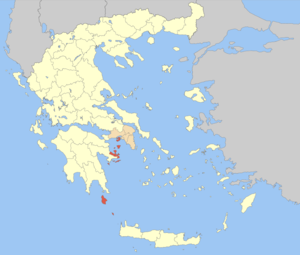
الجزر، الوحدة المحلية (باليونانية: Περιφερειακή ενότητα Νήσων, Periphereiaki enotita Nison؛ إنگليزية: Islands Regional Unit) is one of the regional units of Greece. It is part of the region of Attica. The regional unit covers the Saronic Islands, a small part of the Peloponnese peninsula, and a few islands off the eastern Peloponnese coast.
. . . . . . . . . . . . . . . . . . . . . . . . . . . . . . . . . . . . . . . . . . . . . . . . . . . . . . . . . . . . . . . . . . . . . . . . . . . . . . . . . . . . . . . . . . . . . . . . . . . . . . . . . . . . . . . . . . . . . . . . . . . . . . . . . . . . . . . . . . . . . . . . . . . . . . . . . . . . . . . . . . . . . . . .
الادارة
As a part of the 2011 Kallikratis government reform, the regional unit Islands was created out of part of the former Piraeus Prefecture. It is subdivided into 8 municipalities. These are:[1]
انظر أيضاً
المراجع
- ^ "Kallikratis reform law text" (PDF).
- Pages using gadget WikiMiniAtlas
- Short description is different from Wikidata
- Coordinates on Wikidata
- Pages using infobox settlement with unknown parameters
- Pages using infobox settlement with no map
- Articles containing Greek-language text
- Articles containing إنگليزية-language text
- Pages using Lang-xx templates
- Regional units of Attica
- الوحدات المحلية في اليونان
- 2011 establishments in Greece
- Islands (regional unit)
