إيل-دى-فرانس
Île-de-France | |
|---|---|
 | |
| البلد | |
| عاصمة الإقليم | پاريس |
| الأقاليم | |
| الحكومة | |
| • الرئيس | Jean-Paul Huchon (PS) |
| المساحة | |
| • الإجمالي | 12٬012 كم² (4٬638 ميل²) |
| التعداد (Jan. 2013)[1] | |
| • الإجمالي | 11٬978٬363 |
| • الكثافة | 1٬000/km2 (2٬600/sq mi) |
| منطقة التوقيت | UTC+1 (CET) |
| • الصيف (التوقيت الصيفي) | UTC+2 (CEST) |
| ISO 3166 code | FR-J |
| GDP/ Nominal | € 612.3 billion (2012)[2] |
| GDP per capita | € 51,250 ({{{GDP_cap_year}}}){{{GDP_cap_ref}}} |
| المنطقة الاوروبية | FR1 |
| الموقع الإلكتروني | www.iledefrance.fr |
إيل-دي-فرانس (بالفرنسية: Île-de-France) هي منطقة في شمال وسط فرنسا، وعاصمتها مدينة باريس
الجغرافيا

طبيعة إيل=ده-فرانس: منظر غابة فونتانبلو.
التاريخ

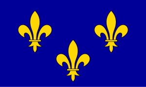
Royal flag, sometimes used unofficially as a flag for the Region[3]
الديمغرافيا
| المساحة المتمركزة | department | population (Jan. 2011 estimate)[4] |
area | التعداد density |
نمو السكان السنوي 2006–2011[4] |
|---|---|---|---|---|---|
| المركز | پاريس (75) | 2,249,975 | 105 كم² | 21,428/كم² | +0.62% |
| الحلقة الداخلية (كورون الصغرى) |
Hauts-de-Seine (92) | 1,581,628 | 176 كم² | 8,987/كم² | +0.59% |
| سين-سان-دني (93) | 1,529,928 | 236 كم² | 6,483/كم² | +0.50% | |
| ڤال-دى-مارن (94) | 1,333,702 | 245 كم² | 5,444/كم² | +0.54% | |
| الإجمالي الجزئي للحلقة الداخلية | 4,445,258 | 657 كم² | 6,766/كم² | +0.54% | |
| الحلقة الخارجية (grande couronne) |
Seine-et-Marne (77) | 1,338,427 | 5,915 كم² | 226/كم² | +1.00% |
| Yvelines (78) | 1,413,635 | 2,284 كم² | 619/كم² | +0.25% | |
| إسون (91) | 1,225,191 | 1,804 كم² | 679/كم² | +0.45% | |
| ڤال-دواز (95) | 1,180,365 | 1,246 كم² | 947/كم² | +0.40% | |
| الإجمالي الجزئي للحلقة الخارجية | 5,157,618 | 11,249 كم² | 458/كم² | +0.52% | |
| الإجمالي | 11,852,851 | 12,011 كم² | 987/كم² | +0.55% | |
كورون الصغرى

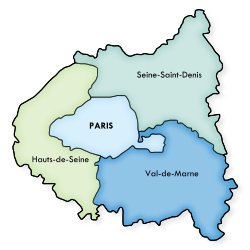
Locator map showing the municipalities in which the Petite Couronne is divided. Paris is divided into its 20 arrondissements
The table below shows some statistical information about the area including Paris:
| القسم | المساحة (كم²) | التعداد[4] | البلديات |
|---|---|---|---|
| پاريس (75) | 105.4
|
2,249,975
|
1 (Paris)
|
| أعالي السين (92) | 176
|
1,581,628
|
|
| سين-سان-دني (93) | 236
|
1,529,928
|
|
| ڤال-دى-مارن (94) | 245
|
1,333,702
|
|
| كورون الصغرى | 657
|
4,445,258
|
123
|
| پاريس + كورون الصغرى | 762.4
|
6,695,233
|
124
|
تاريخ التعداد
| 1801 census |
1806 census |
1821 census |
1826 census |
1831 census |
1836 census |
1841 census |
1846 census |
1851 census |
1856 census |
1861 census |
1866 census |
|---|---|---|---|---|---|---|---|---|---|---|---|
| 1,352,280 | 1,407,272 | 1,549,811 | 1,780,900 | 1,707,181 | 1,882,354 | 1,998,862 | 2,180,100 | 2,239,695 | 2,552,980 | 2,819,045 | 3,039,043 |
| 1872 census |
1876 census |
1881 census |
1886 census |
1891 census |
1896 census |
1901 census |
1906 census |
1911 census |
1921 census |
1926 census |
1931 census |
| 3,141,730 | 3,320,162 | 3,726,118 | 3,934,314 | 4,126,932 | 4,368,656 | 4,735,580 | 4,960,310 | 5,335,220 | 5,682,598 | 6,146,178 | 6,705,579 |
| 1936 census |
1946 census |
1954 census |
1962 census |
1968 census |
1975 census |
1982 census |
1990 census |
1999 census |
2006 census |
2011 census |
2013 estimate |
| 6,785,750 | 6,597,758 | 7,317,063 | 8,470,015 | 9,248,631 | 9,878,565 | 10,073,059 | 10,660,554 | 10,952,011 | 11,532,398 | 11,852,851 | 11,978,363 |
| Census returns until 2011; official January estimates from INSEE from 2012 on. | |||||||||||
العلاقات الدولية
مناطق توأم
Île-de-France is twinned with:
 Comunidad de Madrid in Spain (منذ 2000)
 يريڤان في أرمنيا (since 2011)[5]
الهامش
- ^ (بالفرنسية) INSEE. "Estimation de population au 1er janvier, par région, sexe et grande classe d'âge – Année 2013". Retrieved 2014-02-20.
- ^ INSEE. "Produits intérieurs bruts régionaux et valeurs ajoutées régionales de 1990 à 2012". Retrieved 2014-03-04.
- ^ The flag is the France Moderne coat of arms (a simplified version of the France Ancien reduced the number of fleurs-de-lis to three), emblem of the French Monarchy, symbole of Île-de-France's prominence
- ^ أ ب ت (بالفرنسية) INSEE. "Estimation de population au 1er janvier, par département, sexe et grande classe d'âge – Année 2011". Retrieved 2014-02-20.
- ^ "Yerevan - Partner Cities". Yerevan Municipality Official Website. © 2005—2013 www.yerevan.am. Retrieved 2013-11-04.
وصلات خارجية
Wikivoyage has a travel guide for Île-de-France.
All content in this article is created by Marefa contributors and is © Marefa. All rights reserved.
تصنيفات:
- Pages using gadget WikiMiniAtlas
- Short description with empty Wikidata description
- Pages using infobox settlement with no coordinates
- Articles with hatnote templates targeting a nonexistent page
- Missing redirects
- Pages with empty portal template
- Coordinates not on Wikidata
- إيل-دى-فرانس
- أقاليم التصنيف الأول في الاتحاد الأوروپي
- أقاليم التصنيف الثاني في الاتحاد الأوروپي
- مناطق فرنسا
- إيل ده فرانس


