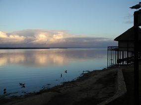
إيسيمانگاليسو، منتزه الأراضي الرطبة
| iSimangaliso Wetland Park | |
|---|---|
 Greater St. Lucia Wetlands | |
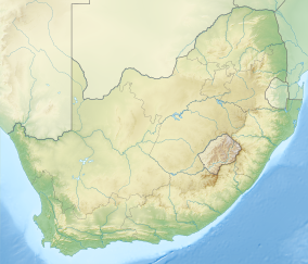
Location of the park within of South Africa | |
| الموقع | KwaZulu-Natal, South Africa |
| أقرب مدينة | Durban, South Africa |
| الإحداثيات | 28°0′0″S 32°30′0″E / 28.00000°S 32.50000°E |
| المساحة | 3,280 km2 (1,270 sq mi) |
| تأسست | 1895 |
| الهيئة الحاكمة | iSimangaliso Authority |
| موقع تراث عالمي لليونسكو | |
| السمات | طبيعي: (vii), (ix), (x) |
| مراجع | 914 |
| التدوين | 1999 (23rd Session) |
| المساحة | 239,566 ha (924.97 sq mi) |
| موقع إلكتروني | http://www.isimangaliso.com/ |
| الاسم الرسمي | St. Lucia System |
| التوصيف | 2 October 1986 |
| الرقم المرجعي | 345[1] |
إيسيمانگاليسو، منتزه الأراضي الرطبة، في جنوب أفريقيا(previously known as the Greater St. Lucia Wetland Park) تقع على الساحل الشرقي لـ كوازولو-ناتال، جنوب أفريقيا، على بعد 275 كيلومتر شمال دربان. وهي ثالث أكبر محمية في جنوب أفريقيا، spanning 280 km of coastline, from the Mozambican border in the north to Mapelane south of the Lake St. Lucia estuary, and made up of around 3,280 km² of natural ecosystems, managed by the iSimangaliso Authority. The park includes:
- بحيرة سانتا لوتشيا
- St. Lucia Game Reserve
- False Bay Park
- خليج كوسي
- Lake Etrza Nature Reserve
- Lake Sibhayi
- St. Lucia Marine Reserve
- St. Lucia Marine Sanctuary
- Sodwana Bay National Park
- Mapelane Nature Reserve
- Maputaland Marine Reserve
- Cape Vidal
- Ozabeni
- Mfabeni
- Tewate Wilderness Area
- Mkuze Game Reserve
The park was previously known as the Greater St. Lucia Wetland Park, but was renamed effective from 1 November 2007. The word isimangaliso means "miracle" in Zulu.
. . . . . . . . . . . . . . . . . . . . . . . . . . . . . . . . . . . . . . . . . . . . . . . . . . . . . . . . . . . . . . . . . . . . . . . . . . . . . . . . . . . . . . . . . . . . . . . . . . . . . . . . . . . . . . . . . . . . . . . . . . . . . . . . . . . . . . . . . . . . . . . . . . . . . . . . . . . . . . . . . . . . . . . .
منتزه عبر التخوم
الملاحظات والمراجع
- ^ "St. Lucia System". Ramsar Sites Information Service. Retrieved 25 April 2018.


