إيتوليا-أكارنانيا
إيتوليا-أكارنانيا
Περιφερειακή ενότητα Αιτωλοακαρνανίας Etolia-Acarnania | |
|---|---|
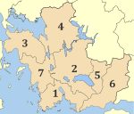 بلديات إيتوليا-أكارنانيا | |
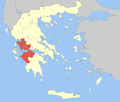
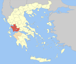 Aetolia-Acarnania within Greece | |
| الإحداثيات: 38°40′N 21°25′E / 38.667°N 21.417°E | |
| البلد | اليونان |
| المنطقة الجغرافية | وسط اليونان |
| المنطقة الإدارية | غرب اليونان |
| العاصمة | مسولونگي |
| المساحة | |
| • الإجمالي | 5٬461 كم² (2٬109 ميل²) |
| التعداد (2011[1]) | |
| • الإجمالي | 210٬802 |
| • الكثافة | 39/km2 (100/sq mi) |
| منطقة التوقيت | UTC+2 |
| • الصيف (التوقيت الصيفي) | UTC+3 (EEST) |
| Postal codes | 30x xx |
| Area codes | 263x0, 264x0 |
| ISO 3166 code | GR-01 |
| Car plates | ΑΙ, ΜΕ |
| الموقع الإلكتروني | www |
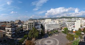
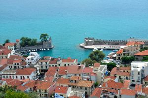
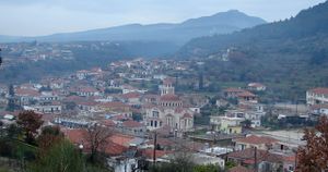
إيتوليا-أكارنانيا (باليونانية: Αιτωλοακαρνανία؛ Aitoloakarnanía؛ [etolo.akarnaˈɲi.a]؛ إنگليزية: Aetolia-Acarnania)، هي إحدى الوحدات المحلية في اليونان. وهي جزء من المنطقة الجغرافية وسط اليونان، والمنطقة الإدارية غرب اليونان. وهي جمع للمنطقتين التاريخيتين إيتوليا وأكارنانيا، لتصبح أكبر وحدة محلية في اليونان. وعاصمتها هي مسولونگي لأسباب تاريخية، بينما أكبر مدنها ومركزها الاقتصادي هو أگرينيو. المنطقة مرتبطة حالياً بشبه جزيرة المورة عبر جسر ريو-أنتيريو.
. . . . . . . . . . . . . . . . . . . . . . . . . . . . . . . . . . . . . . . . . . . . . . . . . . . . . . . . . . . . . . . . . . . . . . . . . . . . . . . . . . . . . . . . . . . . . . . . . . . . . . . . . . . . . . . . . . . . . . . . . . . . . . . . . . . . . . . . . . . . . . . . . . . . . . . . . . . . . . . . . . . . . . . .
تاريخ التعداد
- 1981: 218,362
- 1991: 230,688
- 2001: 224,429
- 2011: 210,802
الادارة
The regional unit Aetolia-Acarnania is subdivided into 7 municipalities. These are (number as in the map in the infobox):[2]
- Agrinio (2)
- Aktio-Vonitsa (3)
- Amfilochia (4)
- Messolonghi (1)
- Nafpaktia (6)
- Thermo (5)
- Xiromero (7)
Prefecture
As a part of the 2011 Kallikratis government reform, the regional unit Aetolia-Acarnania was created out of the former prefecture Aetolia-Acarnania (باليونانية: Νομός Αιτωλοακαρνανίας). The prefecture had the same territory as the present regional unit. At the same time, the municipalities were reorganised, according to the table below.[2]
| البلدية الجديدة | البلديات القديمة | المقر |
|---|---|---|
| Agrinio | Agrinio | Agrinio |
| Angelokastro | ||
| Arakynthos | ||
| Thestieis | ||
| Makryneia | ||
| Neapoli | ||
| Panaitoliko | ||
| Paravola | ||
| Parakampylia | ||
| Stratos | ||
| Aktio-Vonitsa | Anaktorio | Vonitsa |
| Medeon | ||
| Palairos | ||
| Amfilochia | Amfilochia | Amfilochia |
| Inachos | ||
| Menidi | ||
| ميسولونگي (ميسولونگي) |
ميسولونگي | ميسولونگي |
| Aitoliko | ||
| Oiniades | ||
| Nafpaktia | Naupactus | Naupactus |
| Antirrio | ||
| Apodotia | ||
| Platanos | ||
| Pyllini | ||
| Chalkeia | ||
| Thermo | Thermo | Thermo |
| Xiromero | Astakos | Astakos |
| Alyzia | ||
| Fyteies |
Provinces
- Province of Messolonghi - Messolonghi/Messolongi
- Province of Nafpaktia - Nafpaktos
- Province of Trichonida - Agrinio
- Province of Valtos - Amfilochia
- Province of Vonitsa & Xiromero - Vonitsa
Note: Provinces no longer hold any legal status in Greece.
انظر أيضاً
الهامش
- ^ Detailed census results 2011 Archived 2013-12-25 at the Wayback Machine (باليونانية)
- ^ أ ب "Kallikratis reform law text" (PDF).
وصلات خارجية
- Pages using gadget WikiMiniAtlas
- Short description is different from Wikidata
- Coordinates on Wikidata
- Pages using infobox settlement with unknown parameters
- Articles containing Greek-language text
- Articles containing إنگليزية-language text
- Pages using Lang-xx templates
- إيتوليا-أكارنانيا
- الوحدات المحلية في اليونان
- تأسيسات 1833 في اليونان
- الوحدات المحلية في غرب اليونان
- مقاطعات اليونان
