أولت (نهر)
| Râul Olt | |
 The Avrig reservoir on the Olt
| |
| Countries | Romania |
|---|---|
| Counties | Harghita, Covasna, Brașov, Sibiu, Vâlcea, Olt, Teleorman |
| الروافد | |
| - يسار | Râul Negru, Bârsa, Topolog |
| - يمين | Cormoș, Cibin, Lotru, Olteț |
| Cities | Sfântu Gheorghe, Râmnicu Vâlcea, Slatina |
| Source | |
| - الموقع | Hășmaș Mountains, Bălan, Harghita |
| - elevation | 1,440 m (4,724 ft) |
| المصب | Danube |
| - الموقع | near Turnu Măgurele |
| الطول | 615 km (382 mi) |
| الحوض | 24,050 km2 (9,286 sq mi) |
| التدفق | for * |
| - المتوسط | 190 m3/s (6,710 cu ft/s) |
| Official River Code Progression |
VIII.1 الدانوب← البحر الأسود |
 | |
نهر أولت "Olt" من أهم أنهار رومانيا وإحدى روافد نهر الدانوب من جبال الكارابات الشرقية ويمر بالعديد من المدن والمقاطعات الرومانية. يبلغ طوله 615 كم ويشكل في مساره 30 بحيرة.
البلدات والقرى

The following towns and villages are situated along the river Olt, from source to mouth (incomplete list): Bălan, Sândominic, Miercurea Ciuc, Sfântu Gheorghe, Făgăraș, Brezoi, Călimănești, Râmnicu Vâlcea, Drăgășani, Slatina, Drăgănești-Olt.
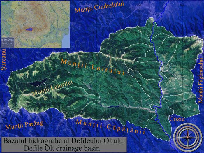
خريطة قابلة للنقر لحوض صرف (ro:Defileul Oltului)/(en:Olt Defile)
الترخيص
معرض صور
Olt – Close to the source, at Siculeni
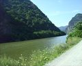
The Olt River at Turnu Roșu

Carol Popp de Szathmary, Olt Valley
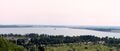
Slatina storage reservoir on the Olt river


- More pictures: Raft ride (rafting) on Olt
انظر أيضاً
الهامش
- Administrația Națională Apelor Române - Cadastrul Apelor - București
- Institutul de Meteorologie și Hidrologie - Rîurile României - București 1971
وصلات خارجية

خطأ لوا في وحدة:Authority_control على السطر 278: attempt to call field '_showMessage' (a nil value).
الكلمات الدالة: