أسنينغ
| Teutoburg Forest | |
|---|---|
| Teutoburger Wald | |
 View over the Teutoburg Forest | |
 The south part of the Teutoburg Forest in North West Germany | |
| الموقع | Germany (north-west) Lower Saxony & NRW |
| أقرب مدينة | Bielefeld Paderborn (to the south) Osnabrück (to the north-west) |
| الإحداثيات | 51°54′00″N 8°49′00″E / 51.90000°N 8.81667°E |
| المساحة | ح. 4,000 km2 (1,500 sq mi) almost all of it included officially in one of two natural parks: 1,220 km2 (470 sq mi) (TERRA.vita Nature Park) 2,711 km2 (1,047 sq mi) (Teutoburg Forest / Egge Hills Nature Park) |
أسننگ (بالألمانية: Osning) أو بالإسم الشائع اليوم غابة تويتوبورگ (بالألمانية: Teutoburger Wald) هي سلسلة جبال بارتفاع اقصى يبلغ 446 مترا تمتد في ولايتي سكسونيا السفلى وشمال الراين - وستفاليا الألمانييتين.
أشتهرت أسنينغ بمعركة غابة تويتوبورغ أو واروس بين الرومان والجرمان في سنة 9 ميلادية، رغم أن الأبحاث التاريخية أثبتت أن المعركة لم تقع في الغابة بل في منطقة كالكريزه.
تحتضن أسنينغ العديد من المناطق السياحية، منها النصب التذكاري لقائد معركة واروس "هيرمان" أو باللاتينية "أرمينيوس" والمحمية الطبيعية "أحجار الإكستيرن" وجرف دورينته التي يحمل على قمته صخرة "المرأة القرفصاء"

Winter Scenery at the Teutoburg Forest

Fall Scenery at the Teutoburg Forest
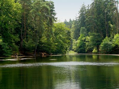
Donop's Pond (Donoperteich)

Tip of the Velmerstot Mountain


.jpg&filetimestamp=20230226160628&)
.jpg&filetimestamp=20230226160623&)

External links
 Media related to Teutoburg Forest at Wikimedia Commons

خطأ لوا في وحدة:Authority_control على السطر 278: attempt to call field '_showMessage' (a nil value).
- ^ "Hermann Trail: One of Germany's most beautiful high-altitude trails". Tourismus NRW e.V. Düsseldorf, Germany. Retrieved 14 أغسطس 2021.
- Pages using gadget WikiMiniAtlas
- Short description is different from Wikidata
- Use dmy dates from August 2021
- Articles containing ألمانية-language text
- Coordinates on Wikidata
- Teutoburg Forest
- Forests and woodlands of Germany
- Forests and woodlands of Lower Saxony
- Mountains and hills of North Rhine-Westphalia
- جغرافيا ألمانيا
- جغرافيا شمال الراين - وستفاليا
- بذرة ألمانيا