آلا كول
| آلا-كول | |
|---|---|
| Алакөл Error {{native name checker}}: parameter value is malformed (help) | |
 | |
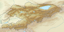
| الموقع | Terskey Alatau |
| الاحداثيات | 42°19′3″N 78°32′8″E / 42.31750°N 78.53556°E |
| نوع البحيرة | مسدودة بصخور |
| منطقة المستجمعات | 9.46 كم² |
| بلدان الحوض | قيرغيزستان |
| أقصى طول | 2.3 كم |
| أقصى عرض | 0.7 كم |
| ارتفاع السطح | 3560 متر |
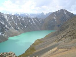
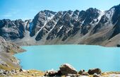
آلا كول أو ألا-كول (Ala Köl ؛ قرغيزية: Алакөл) هي بحيرة مسدودة صخرياً في سلسلة جبال Terskey Alatau في Ak-Suu District في منطقة إيسيك كول في قيرغيزستان. وتقع على ارتفاع حوالي 3560 متر فوق سطح البحر.
التاريخ
The lake is already thought to be reported in the account given by Rubruquis of his voyage to the Qaraqorum, but he thinks it to be an inner sea, the oriental end of the Lake Balkach. He gives an approximate description of the area and mentions the winds, which are "so strong that people do not traverse the lake without great peril." [1]
A Russian traveller named Putimtsoff was the first to knowingly visit the lake in 1811. He gave a good description of it, mentioning rocks of different colours in the lake, and the furious winds blowing around the lake. Thirty years later Alexander Schrenk explored the lake and its surroundings.[2]
Literally, the name Ala-kul would mean 'variegated lake,' although it probably takes its name from the Ala-Таu mountains lying further north.[3]
انظر أيضاً
المراجع
- ^ Rubruquis, G. (1255), Voyage dans l'Empire Mongol, p. 188, Petit Biblio Payot Voyageurs
- ^ Bretschneider, E. (1910), Mediæval researches from eastern Asiatic sources: Fragments towards the knowledge of the geography and history of central and western Asia from the 13th to the 17th century, p. 126, Michigan University
- ^ Taylor, Issac (1898), Names and their histories: a handbook of historical geography and topographical nomenclature, p. 317, Rivingtons
وصلات خارجية
 Media related to Ala-Kul at Wikimedia Commons


