ملف:Zakarid Armenia 1200 map-fr.svg

حجم معاينة PNG لذلك الملف ذي الامتداد SVG: 800 × 470 بكسل. البعد الآخر: 2٬560 × 1٬503 بكسل.
الملف الأصلي (ملف SVG، أبعاده 2٬717 × 1٬595 بكسل، حجم الملف: 686 كيلوبايت)
وصف قصير
| ⧼wm-license-information-description⧽ |
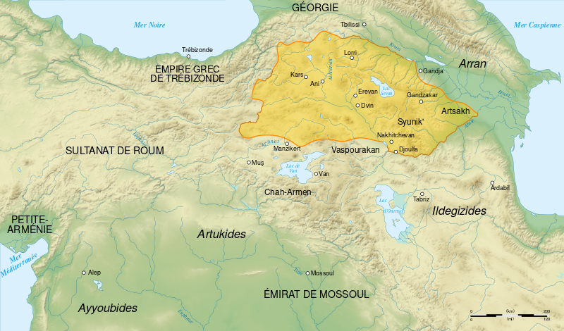
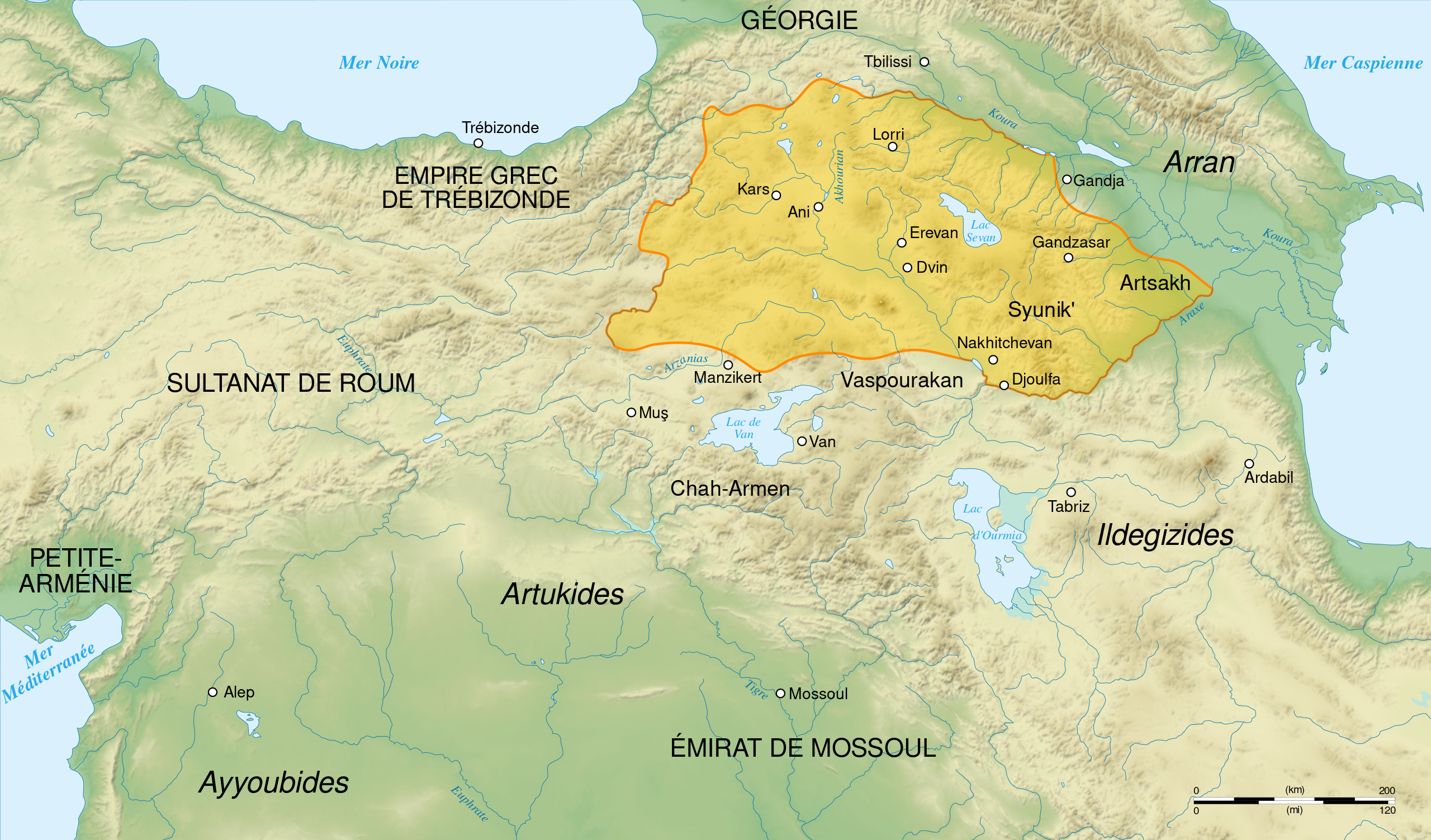
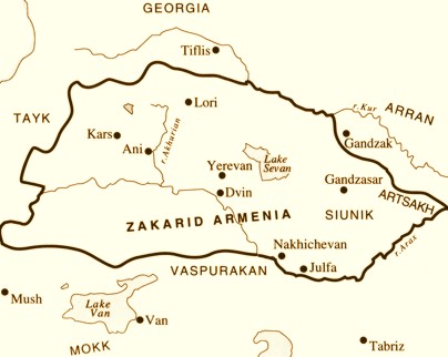
English: French map of Zakarid Armenia, around the year 1200 AD. (Source: George A. Bournoutian - «A Concise History of the Armenian People», map 19. Mazda Publishers, Inc. Costa Mesa California 2006)
Français : Carte en français de l'Arménie zakaride, vers l'an mille.
|
||
| ⧼wm-license-information-date⧽ | 2008 | ||
| ⧼wm-license-information-source⧽ | ⧼Wm-license-own-work⧽. Sources :
Logiciels utilisés :
Autres données :
|
||
| ⧼wm-license-information-author⧽ | Sémhur | ||
| ⧼wm-license-information-other-versions⧽ | |||
| SVG |
قالب:ValidSVG
|
||
| Graphic Lab | قالب:Atelier graphique carte |
ترخيص
تاريخ الملف
اضغط على زمن/تاريخ لرؤية الملف كما بدا في هذا الزمن.
| زمن/تاريخ | صورة مصغرة | الأبعاد | مستخدم | تعليق | |
|---|---|---|---|---|---|
| حالي | ★ مراجعة معتمدة 03:45، 16 أكتوبر 2023 | | 2٬717 × 1٬595 (686 كيلوبايت) | Pastakhov (نقاش | مساهمات) | Upload https://upload.wikimedia.org/wikipedia/commons/3/35/Zakarid_Armenia_1200_map-fr.svg |
لا يمكنك استبدال هذا الملف.
وصلات
لا يوجد صفحات تصل لهذه الصورة.