ملف:Yugoslavia location map.svg

حجم معاينة PNG لذلك الملف ذي الامتداد SVG: 450 × 521 بكسل. البعد الآخر: 1٬769 × 2٬048 بكسل.
الملف الأصلي (ملف SVG، أبعاده 450 × 521 بكسل، حجم الملف: 762 كيلوبايت)
وصف قصير
| ⧼wm-license-information-description⧽ |
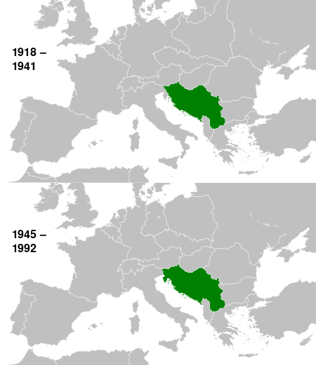
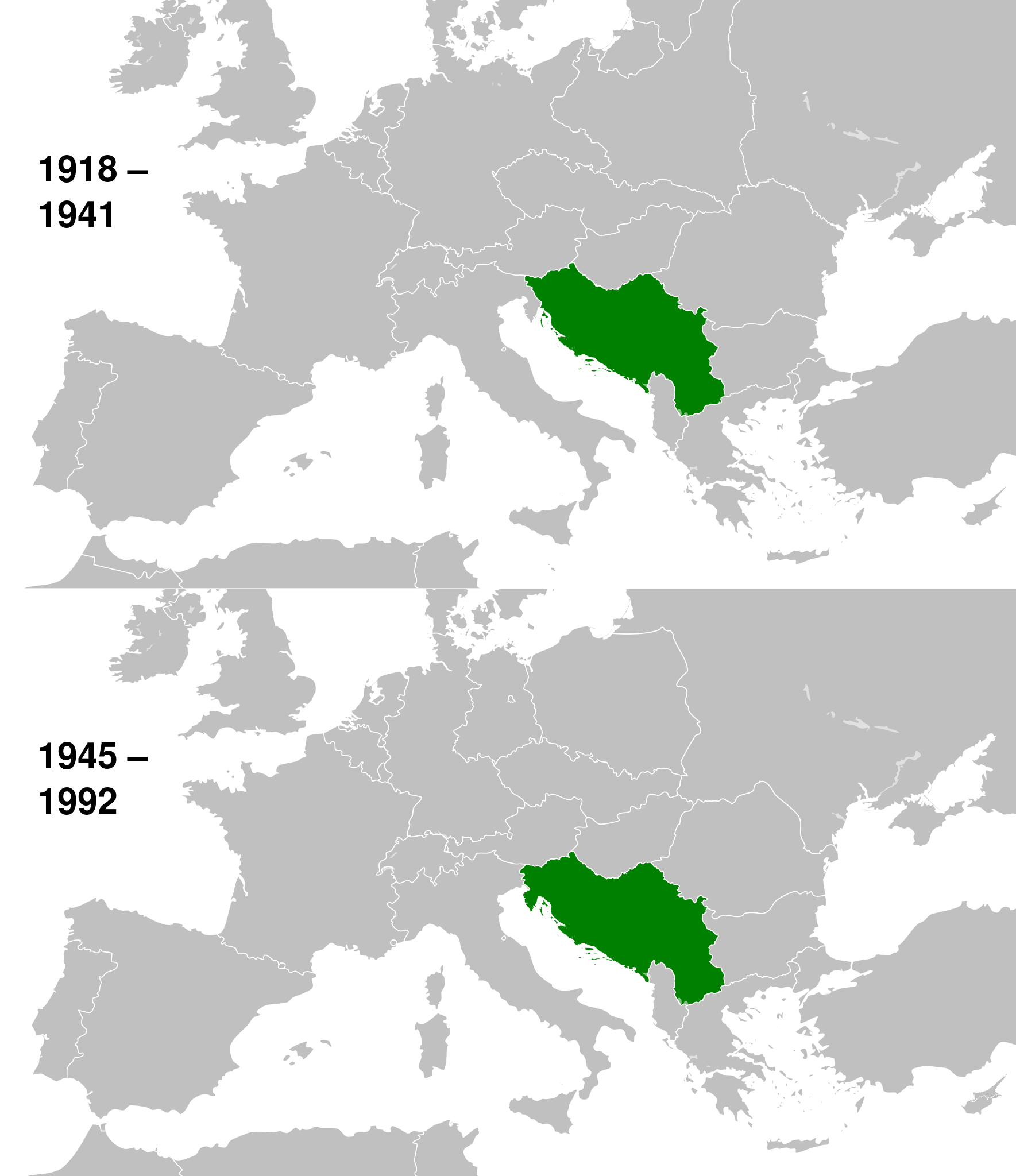
English: This is a map of the evolution of Yugoslavia from 1918 to 1992.
|
| ⧼wm-license-information-date⧽ | 2013, {{time}} – invalid date format 13 (help) |
| ⧼wm-license-information-source⧽ | قالب:Derived from |
| ⧼wm-license-information-author⧽ |
|
ترخيص
|
قالب:Original upload log
This image is a derivative work of the following images:
- File:History_of_Yugoslavia.svg licensed with Cc-by-sa-3.0
تاريخ الملف
اضغط على زمن/تاريخ لرؤية الملف كما بدا في هذا الزمن.
| زمن/تاريخ | صورة مصغرة | الأبعاد | مستخدم | تعليق | |
|---|---|---|---|---|---|
| حالي | ★ مراجعة معتمدة 22:24، 15 ديسمبر 2023 | | 450 × 521 (762 كيلوبايت) | Pastakhov (نقاش | مساهمات) | Upload https://upload.wikimedia.org/wikipedia/commons/6/6c/Yugoslavia_location_map.svg |
لا يمكنك استبدال هذا الملف.
وصلات
لا يوجد صفحات تصل لهذه الصورة.