ملف:Woolston Shipyard - geograph.org.uk - 22542.jpg
لا توجد دقة أعلى متوفرة.
Woolston_Shipyard_-_geograph.org.uk_-_22542.jpg (640 × 427 بكسل حجم الملف: 77 كيلوبايت، نوع MIME: image/jpeg)
وصف قصير
| ⧼wm-license-information-description⧽ |
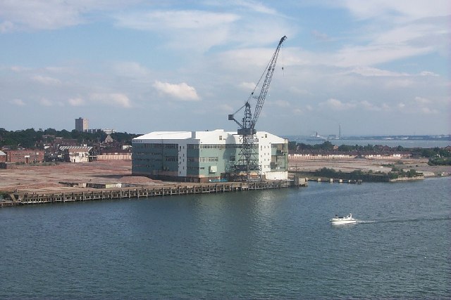
English: Woolston Shipyard. Most of the shipyard is now gone. Ships had been built there for over a hundred years. All soon to be houses and flats. St Mark's Church can be seen just behind and in the distance the flats at Weston. If you look very carefully you will see the Queen Elizabeth 2 sailing down river
|
| ⧼wm-license-information-date⧽ | 2005 |
| ⧼wm-license-information-source⧽ | From geograph.org.uk |
| ⧼wm-license-information-author⧽ | David Mainwood |
| ⧼wm-license-cc-attribution⧽ (قالب:I18n/Credit line) |
David Mainwood / Woolston Shipyard / |
50°53′56″N 1°23′07″W / 50.89880°N 1.3854°W قالب:Object location
_heading:157)
ترخيص
تاريخ الملف
اضغط على زمن/تاريخ لرؤية الملف كما بدا في هذا الزمن.
| زمن/تاريخ | صورة مصغرة | الأبعاد | مستخدم | تعليق | |
|---|---|---|---|---|---|
| حالي | ★ مراجعة معتمدة 18:27، 25 يناير 2024 | | 640 × 427 (77 كيلوبايت) | Pastakhov (نقاش | مساهمات) | Upload https://upload.wikimedia.org/wikipedia/commons/b/b8/Woolston_Shipyard_-_geograph.org.uk_-_22542.jpg |
لا يمكنك استبدال هذا الملف.
وصلات
لا يوجد صفحات تصل لهذه الصورة.