ملف:Willesden Junction Station (Silverlink) - geograph.org.uk - 428479.jpg
لا توجد دقة أعلى متوفرة.
Willesden_Junction_Station_(Silverlink)_-_geograph.org.uk_-_428479.jpg (640 × 480 بكسل حجم الملف: 106 كيلوبايت، نوع MIME: image/jpeg)
وصف قصير
| ⧼wm-license-information-description⧽ |
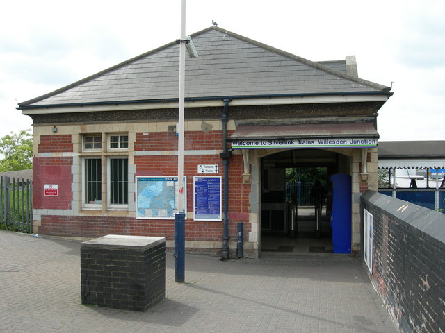
English: Willesden Junction Station (Silverlink). Willesden Junction is a rambling station, with several different access points and platforms in different locations and on different levels and alignments. This is the Silverlink section of the station (see 309924 for the other set of buildings on Station Approach). This is the view you would get if you had come off the footpath from Harrow Road. 428482
|
| ⧼wm-license-information-date⧽ | 2007 |
| ⧼wm-license-information-source⧽ | From geograph.org.uk |
| ⧼wm-license-information-author⧽ | Danny Robinson |
51°31′56″N 0°14′33″W / 51.53224°N 0.2426°W قالب:Object location
_-_geograph.org.uk_-_428479.jpg¶ms=51.53224_N_0.2426_W_source:geograph-osgb36(TQ21998294)_heading:270)
ترخيص
تاريخ الملف
اضغط على زمن/تاريخ لرؤية الملف كما بدا في هذا الزمن.
| زمن/تاريخ | صورة مصغرة | الأبعاد | مستخدم | تعليق | |
|---|---|---|---|---|---|
| حالي | ★ مراجعة معتمدة 14:56، 26 يناير 2024 | | 640 × 480 (106 كيلوبايت) | Pastakhov (نقاش | مساهمات) | Upload https://upload.wikimedia.org/wikipedia/commons/f/f8/Willesden_Junction_Station_%28Silverlink%29_-_geograph.org.uk_-_428479.jpg |
لا يمكنك استبدال هذا الملف.
وصلات
لا يوجد صفحات تصل لهذه الصورة.
_-_geograph.org.uk_-_428479.jpg&oldid=3935632)