ملف:Wigan UK local election 2006 map.svg

حجم معاينة PNG لذلك الملف ذي الامتداد SVG: 686 × 599 بكسل. البعد الآخر: 2٬344 × 2٬048 بكسل.
الملف الأصلي (ملف SVG، أبعاده 1٬425 × 1٬245 بكسل، حجم الملف: 501 كيلوبايت)
وصف قصير
| ⧼wm-license-information-description⧽ |
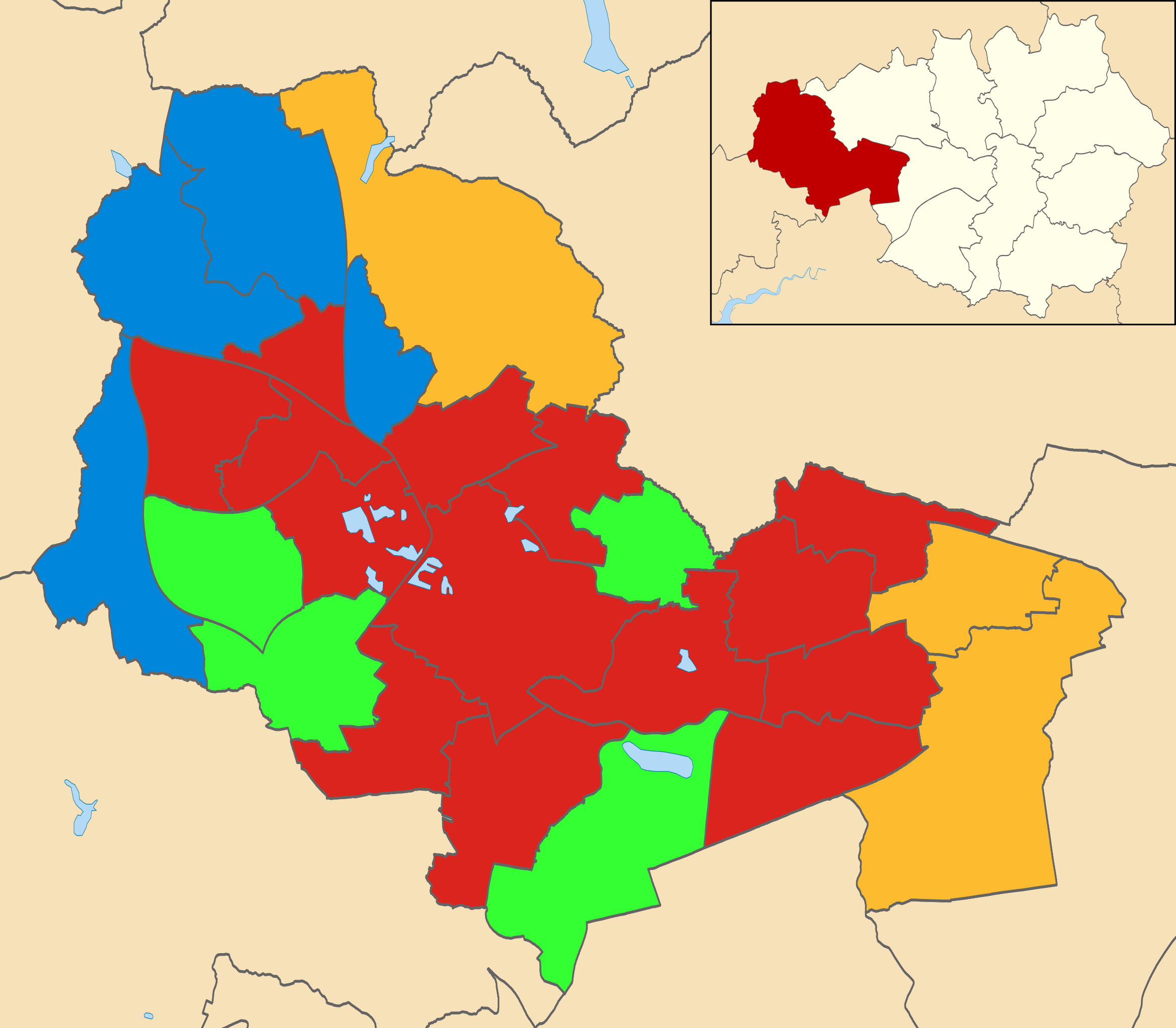
Map of Wigan, Greater Manchester, UK showing the results of the 2006 local election. Colours: Labour
Conservative
Community Action
Liberal Democrat
|
| ⧼wm-license-information-date⧽ | 2012-06-26 15:58 (UTC) |
| ⧼wm-license-information-source⧽ | قالب:Derived from |
| ⧼wm-license-information-author⧽ |
|
.svg&action=edit&redlink=1)
ترخيص
|
قالب:Original upload log
This image is a derivative work of the following images:
- File:Wigan_UK_ward_map_2010_(blank).svg licensed with Cc-by-sa-3.0
- 2011-04-24T22:05:50Z Nilfanion 1425x1245 (513279 Bytes) {{Information |Description=Map of Wigan, Greater Manchester, UK with electoral wards shown. Equirectangular map projection on WGS 84 datum, with N/S stretched 165% Geographic limits: *West: 2.74W *East: 2.40W *North: 53.62N
تاريخ الملف
اضغط على زمن/تاريخ لرؤية الملف كما بدا في هذا الزمن.
| زمن/تاريخ | صورة مصغرة | الأبعاد | مستخدم | تعليق | |
|---|---|---|---|---|---|
| حالي | ★ مراجعة معتمدة 21:08، 7 ديسمبر 2023 | | 1٬425 × 1٬245 (501 كيلوبايت) | Pastakhov (نقاش | مساهمات) | Upload https://upload.wikimedia.org/wikipedia/commons/9/9f/Wigan_UK_local_election_2006_map.svg |
لا يمكنك استبدال هذا الملف.
وصلات
لا يوجد صفحات تصل لهذه الصورة.