ملف:West Hendon Broadway, NW9 - geograph.org.uk - 502865.jpg
لا توجد دقة أعلى متوفرة.
West_Hendon_Broadway,_NW9_-_geograph.org.uk_-_502865.jpg (640 × 480 بكسل حجم الملف: 105 كيلوبايت، نوع MIME: image/jpeg)
وصف قصير
| ⧼wm-license-information-description⧽ |
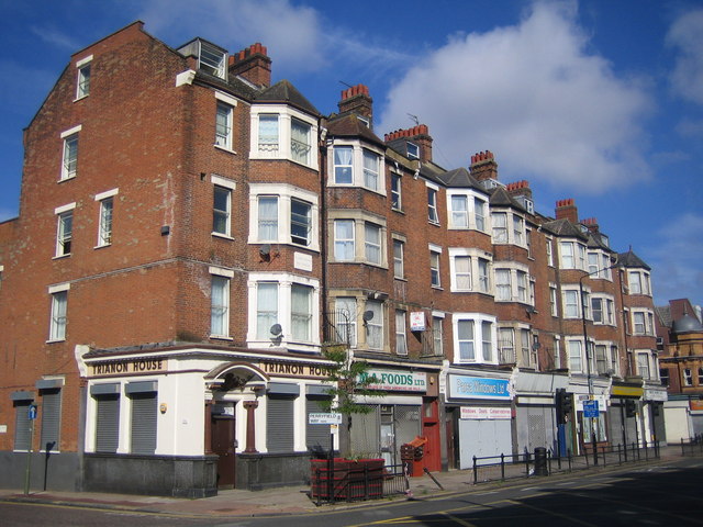
English: West Hendon Broadway, NW9 The former Roman Road of Watling Street and the current A5 West Hendon Broadway just clip across the south western corner of this grid square, and the 188000 Northing runs straight through the near corner of Trianon House here. The stone plaque set in the bay between the first and second floors reads
St John's Parade West Hendon |
| ⧼wm-license-information-date⧽ | 2007 |
| ⧼wm-license-information-source⧽ | From geograph.org.uk |
| ⧼wm-license-information-author⧽ | Nigel Cox |
| ⧼wm-license-cc-attribution⧽ (قالب:I18n/Credit line) |
Nigel Cox / West Hendon Broadway, NW9 / |
51°34′41″N 0°14′24″W / 51.5781°N 0.240°W قالب:Object location
_heading:292)
ترخيص
تاريخ الملف
اضغط على زمن/تاريخ لرؤية الملف كما بدا في هذا الزمن.
| زمن/تاريخ | صورة مصغرة | الأبعاد | مستخدم | تعليق | |
|---|---|---|---|---|---|
| حالي | ★ مراجعة معتمدة 23:34، 6 نوفمبر 2023 | | 640 × 480 (105 كيلوبايت) | Pastakhov (نقاش | مساهمات) | Upload https://upload.wikimedia.org/wikipedia/commons/6/6d/West_Hendon_Broadway%2C_NW9_-_geograph.org.uk_-_502865.jpg |
لا يمكنك استبدال هذا الملف.
وصلات
لا يوجد صفحات تصل لهذه الصورة.