ملف:Ward's Stone - geograph.org.uk - 49511.jpg
لا توجد دقة أعلى متوفرة.
Ward's_Stone_-_geograph.org.uk_-_49511.jpg (640 × 480 بكسل حجم الملف: 81 كيلوبايت، نوع MIME: image/jpeg)
وصف قصير
| ⧼wm-license-information-description⧽ |
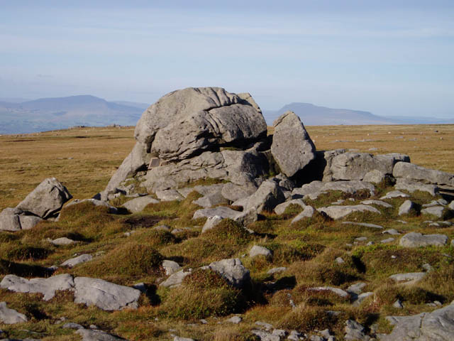
English: Ward's Stone. This tor is probably the highest point in the Forest of Bowland (though the other end of Ward's Stone's summit plateau provides some competition). It's also the highest hill wholly in Lancashire, according to its present-day boundaries. Ingleborough is the prominent hill on the right-hand side.
|
| ⧼wm-license-information-date⧽ | 2005 |
| ⧼wm-license-information-source⧽ | From geograph.org.uk |
| ⧼wm-license-information-author⧽ | David Gruar |
| ⧼wm-license-cc-attribution⧽ (قالب:I18n/Credit line) |
David Gruar / Ward's Stone / |
ترخيص
تاريخ الملف
اضغط على زمن/تاريخ لرؤية الملف كما بدا في هذا الزمن.
| زمن/تاريخ | صورة مصغرة | الأبعاد | مستخدم | تعليق | |
|---|---|---|---|---|---|
| حالي | ★ مراجعة معتمدة 21:35، 19 أكتوبر 2023 | | 640 × 480 (81 كيلوبايت) | Pastakhov (نقاش | مساهمات) | Upload https://upload.wikimedia.org/wikipedia/commons/d/d3/Ward%27s_Stone_-_geograph.org.uk_-_49511.jpg |
لا يمكنك استبدال هذا الملف.
وصلات
لا يوجد صفحات تصل لهذه الصورة.