ملف:Wandel Sea map.png
حجم هذه المعاينة: 600 × 600 بكسل. البعد الآخر: 2٬000 × 2٬000 بكسل.
الملف الأصلي (2٬000 × 2٬000 بكسل حجم الملف: 215 كيلوبايت، نوع MIME: image/png)
وصف قصير
| ⧼wm-license-information-description⧽ |
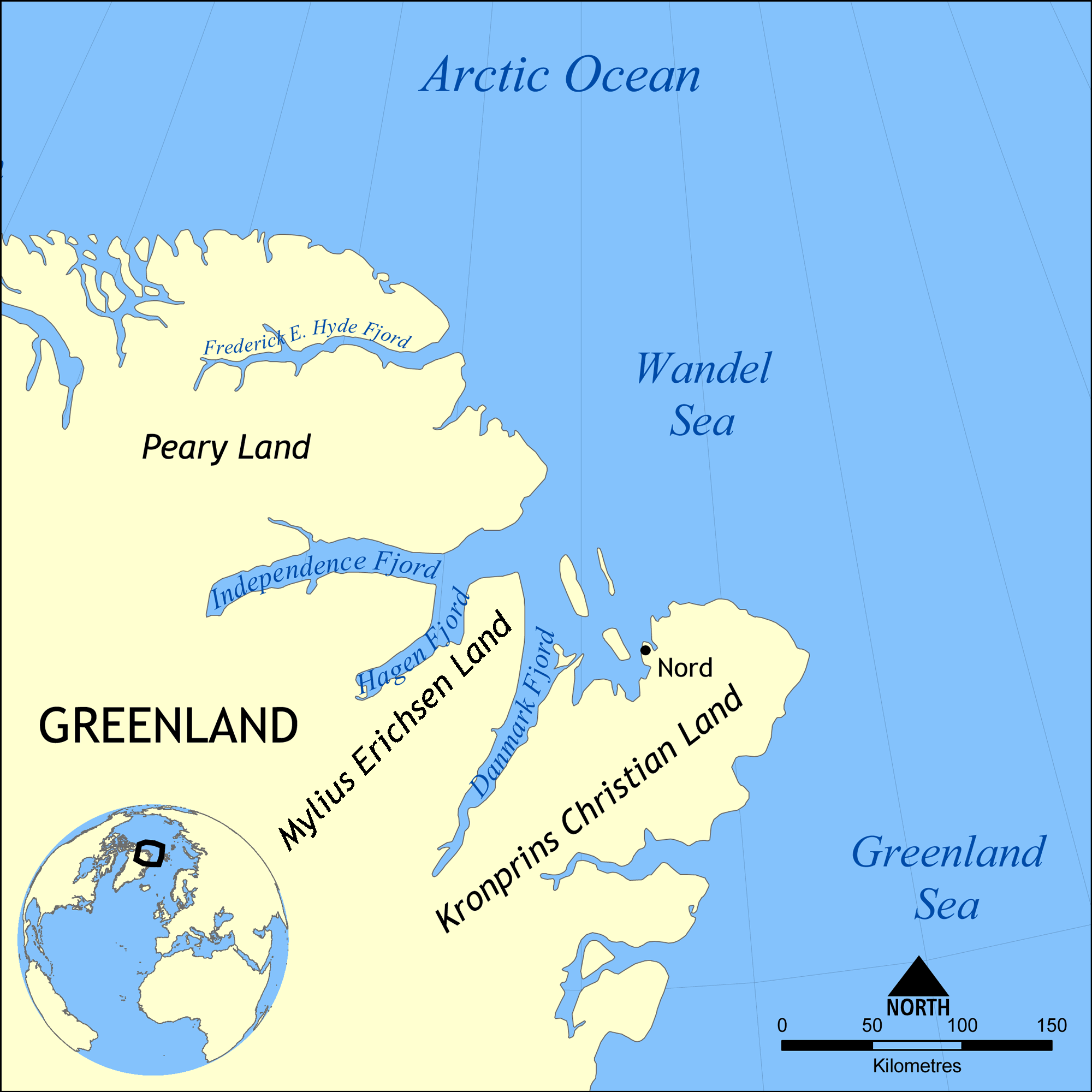
English: This map shows the location of the Wandel Sea northwest of Greenland and west of Svalbard. Nearby bodies of water include the Arctic Ocean, of which it is part, Greenland Sea, Lincoln Sea, Norwegian Sea, and Barents Sea.
|
| ⧼wm-license-information-date⧽ | 2009 |
| ⧼wm-license-information-source⧽ | ⧼Wm-license-own-work⧽ |
| ⧼wm-license-information-author⧽ | NormanEinstein |
| ⧼wm-license-information-other-versions⧽ |
ترخيص
|

تاريخ الملف
اضغط على زمن/تاريخ لرؤية الملف كما بدا في هذا الزمن.
| زمن/تاريخ | صورة مصغرة | الأبعاد | مستخدم | تعليق | |
|---|---|---|---|---|---|
| حالي | ★ مراجعة معتمدة 23:47، 17 أكتوبر 2023 | | 2٬000 × 2٬000 (215 كيلوبايت) | Pastakhov (نقاش | مساهمات) | Upload https://upload.wikimedia.org/wikipedia/commons/8/82/Wandel_Sea_map.png |
لا يمكنك استبدال هذا الملف.
وصلات
لا يوجد صفحات تصل لهذه الصورة.