ملف:Wakanda map.svg

حجم معاينة PNG لذلك الملف ذي الامتداد SVG: 800 × 543 بكسل. البعد الآخر: 2٬560 × 1٬738 بكسل.
الملف الأصلي (ملف SVG، أبعاده 1٬071 × 727 بكسل، حجم الملف: 640 كيلوبايت)
وصف قصير
| ⧼wm-license-information-description⧽ |
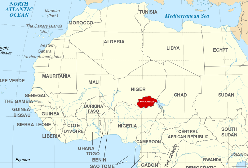
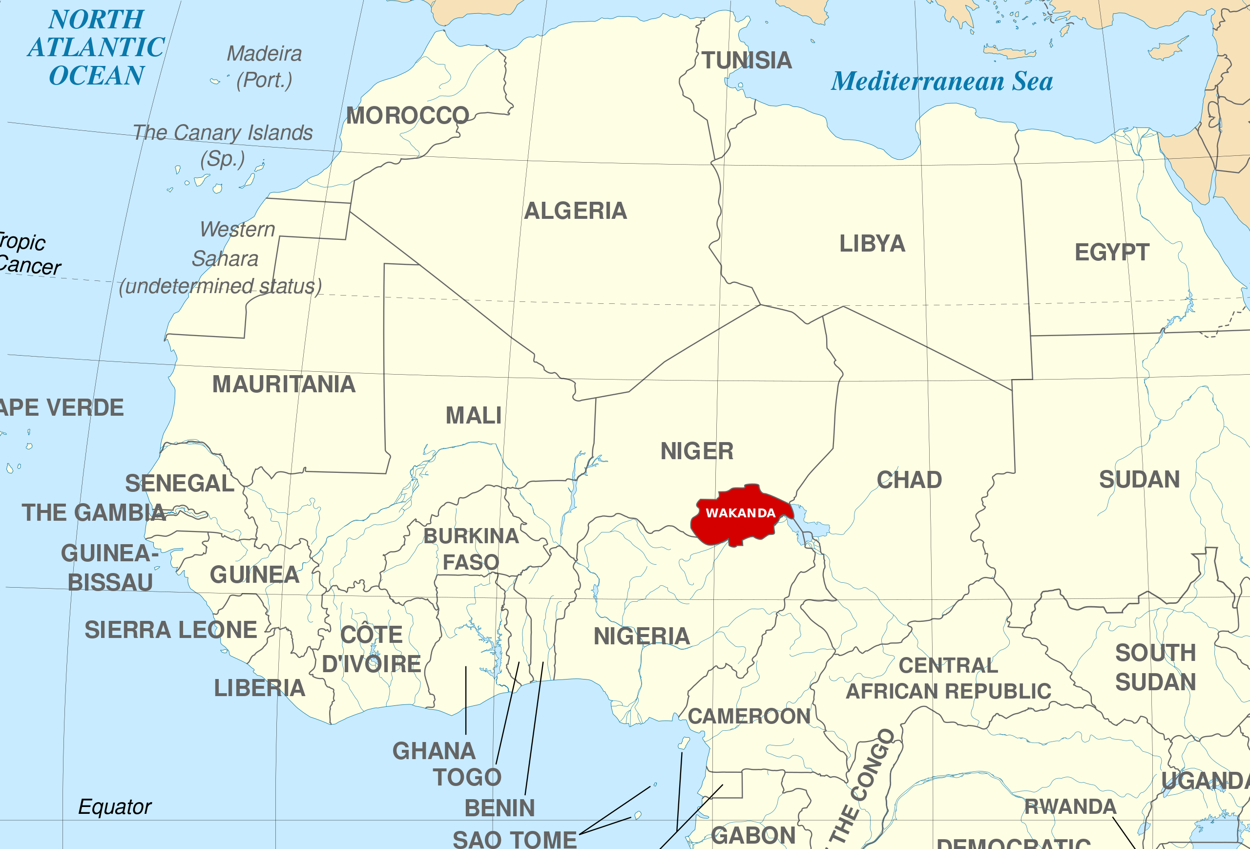
English: A map of the fictional nation Wakanda's location within Africa. Shape and location is based on the Marvel Atlas (2008)
|
| ⧼wm-license-information-date⧽ | 2023 |
| ⧼wm-license-information-source⧽ | قالب:Attrib |
| ⧼wm-license-information-author⧽ | Di (they-them) |
ترخيص
|
تاريخ الملف
اضغط على زمن/تاريخ لرؤية الملف كما بدا في هذا الزمن.
| زمن/تاريخ | صورة مصغرة | الأبعاد | مستخدم | تعليق | |
|---|---|---|---|---|---|
| حالي | ★ مراجعة معتمدة 15:23، 22 يناير 2024 | | 1٬071 × 727 (640 كيلوبايت) | Pastakhov (نقاش | مساهمات) | Upload https://upload.wikimedia.org/wikipedia/commons/4/4c/Wakanda_map.svg |
لا يمكنك استبدال هذا الملف.
وصلات
لا يوجد صفحات تصل لهذه الصورة.