ملف:Waimakariri02 gobeirne.jpg
حجم هذه المعاينة: 800 × 600 بكسل. البعدان الآخران: 2٬560 × 1٬920 بكسل | 3٬072 × 2٬304 بكسل.
الملف الأصلي (3٬072 × 2٬304 بكسل حجم الملف: 2٫06 ميجابايت، نوع MIME: image/jpeg)
وصف قصير
| ⧼wm-license-information-description⧽ |
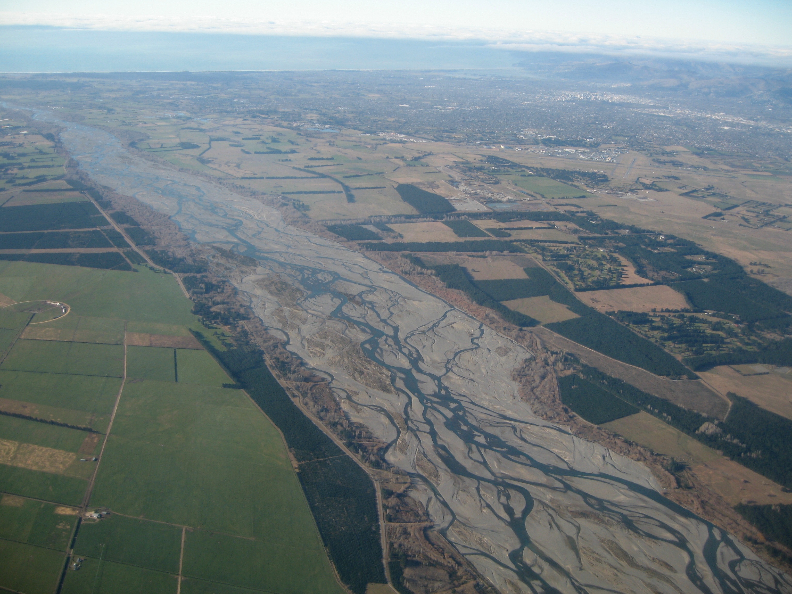
(Finnish) Français : Vue aérienne d'une partie des plaines de Canterbury. La rivière Waimakariri est visible au premier plan, la ville de Christchurch dans le coin supérieur droit de la photo et l'océan Pacifique au dernier plan.
|
||
| ⧼wm-license-information-date⧽ | 2007, {{time}} – invalid date format 10 (help) | ||
| ⧼wm-license-information-source⧽ | ⧼Wm-license-own-work⧽ | ||
| ⧼wm-license-information-author⧽ | Photograph by Greg O'Beirne | ||
| ⧼wm-license-information-permission⧽ (⧼wm-license-information-permission-reusing-text⧽) |
GFDL / Creative Commons |
||
| ⧼wm-license-information-other-versions⧽ |
|
43°25′57.54″S 172°25′38.81″E / 43.4326500°S 172.4274472°E
ترخيص
قالب:Cc-by-sa-3.0-migrated |

تاريخ الملف
اضغط على زمن/تاريخ لرؤية الملف كما بدا في هذا الزمن.
| زمن/تاريخ | صورة مصغرة | الأبعاد | مستخدم | تعليق | |
|---|---|---|---|---|---|
| حالي | ★ مراجعة معتمدة 13:41، 26 أكتوبر 2023 | | 3٬072 × 2٬304 (2٫06 ميجابايت) | Pastakhov (نقاش | مساهمات) | Upload https://upload.wikimedia.org/wikipedia/commons/8/84/Waimakariri02_gobeirne.jpg |
لا يمكنك استبدال هذا الملف.
وصلات
لا يوجد صفحات تصل لهذه الصورة.