ملف:WV banner Malvar Batangas highway.JPG

حجم هذه المعاينة: 799 × 114 بكسل. البعد الآخر: 4٬608 × 658 بكسل.
الملف الأصلي (4٬608 × 658 بكسل حجم الملف: 1٫39 ميجابايت، نوع MIME: image/jpeg)
وصف قصير
| ⧼wm-license-information-description⧽ |
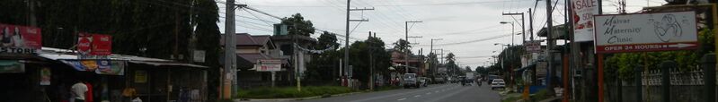
English: General Miguel Malvar[1] ( List of Unofficial Presidents of the Philippines[2]) Monument - Memorial in - Malvar Town Hall (San Pioquinto) J. P. Laurel Highway and General Miguel Malvar Monument in - Coordinates: 14°3'14"N 121°9'16"E - Office of the Mayor Municipal Treasurer's office Office of the Vice Mayor Municipal Administrator office Municipal Engineering office Municipal Planning office Municipal health center -[Coordinates: 14°3'14"N 121°9'16"E] --National Highway - Barangay San Pioquinto[3] Coordinates: 14°3'18"N 121°9'44"E - Elementary School in front of the Muncipio, or Municipal - Town Hall Building Complex[4] --- Malvar, Batangas [5] is a second class municipality in the Province of Batangas[6], Philippines. As of 2009, the population of Malvar was 41,270 and the total number of households was 8,678. The municipality was named after General Miguel Malvar[7], the last Filipino General to surrender to the American Government in the Philippines in 1902.[8] Geographical location: Batangas, Region 4, Philippines, Asia geographical coordinates: 14° 2' 41" North, 121° 9' 31" East [9] Coordinates: 14°1'55"N 121°8'42"E
|
| ⧼wm-license-information-date⧽ | 2013, {{time}} – invalid date format 18 (help) |
| ⧼wm-license-information-source⧽ | ⧼Wm-license-own-work⧽ |
| ⧼wm-license-information-author⧽ | Ramon FVelasquez |
| ⧼wm-license-information-other-versions⧽ |
ترخيص
|
تاريخ الملف
اضغط على زمن/تاريخ لرؤية الملف كما بدا في هذا الزمن.
| زمن/تاريخ | صورة مصغرة | الأبعاد | مستخدم | تعليق | |
|---|---|---|---|---|---|
| حالي | ★ مراجعة معتمدة 16:54، 26 ديسمبر 2023 | 4٬608 × 658 (1٫39 ميجابايت) | Pastakhov (نقاش | مساهمات) | Upload https://upload.wikimedia.org/wikipedia/commons/9/98/WV_banner_Malvar_Batangas_highway.JPG |
لا يمكنك استبدال هذا الملف.
وصلات
لا يوجد صفحات تصل لهذه الصورة.