ملف:Vorderösterreich 1788.jpg
حجم هذه المعاينة: 800 × 600 بكسل. البعد الآخر: 1٬600 × 1٬200 بكسل.
الملف الأصلي (1٬600 × 1٬200 بكسل حجم الملف: 852 كيلوبايت، نوع MIME: image/jpeg)
وصف قصير
| ⧼wm-license-information-description⧽ |
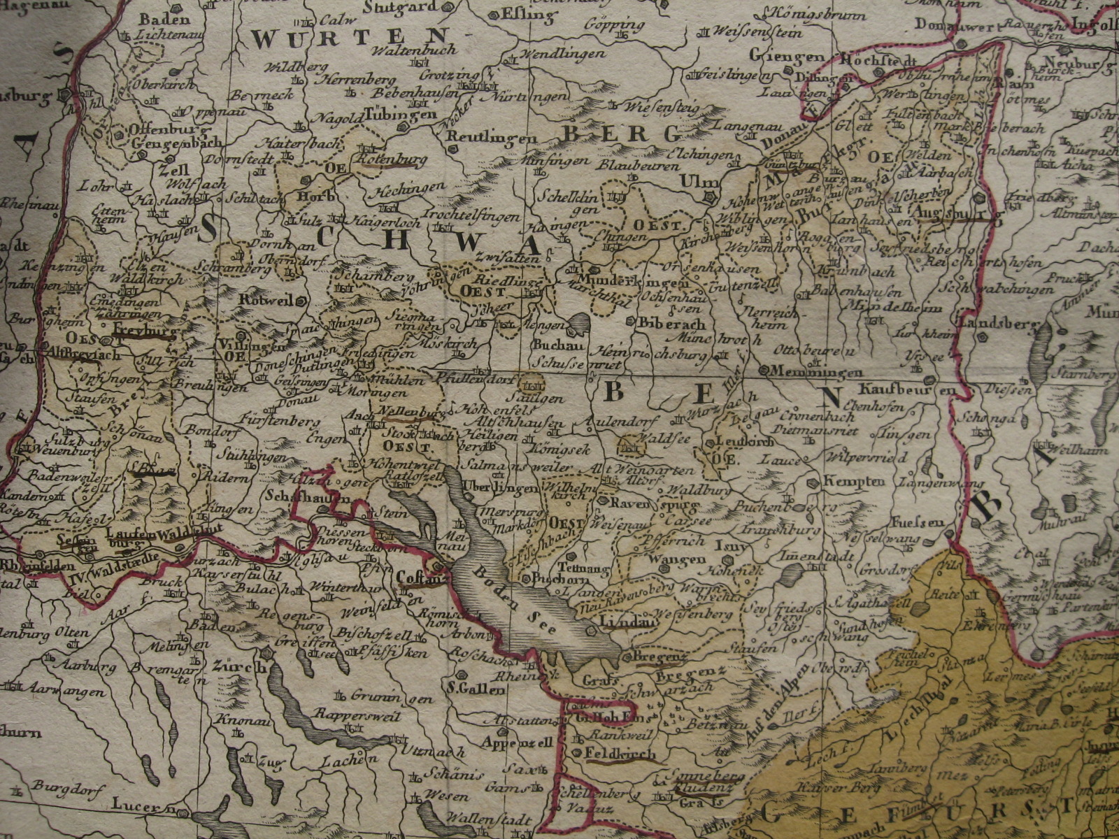
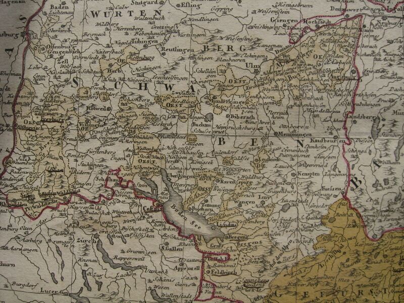
English: Portion of a map of the Austrian Circle showing (in light ochre colour) the many territories of Further Austria (Vorderösterreich) spread throughout Swabia and Vorarlberg. Published by Homann Heirs in 1788.
|
| ⧼wm-license-information-date⧽ | 2012, {{time}} – invalid date format 36 (help) |
| ⧼wm-license-information-source⧽ | Own map |
| ⧼wm-license-information-author⧽ | Homann Heirs (Homannischen Erben), 1788 |
ترخيص
|
|
This file is in the ملكية عامة because its copyright has expired in the United States and those countries with a copyright term of no more than the life of the author plus 100 years.
|
تاريخ الملف
اضغط على زمن/تاريخ لرؤية الملف كما بدا في هذا الزمن.
| زمن/تاريخ | صورة مصغرة | الأبعاد | مستخدم | تعليق | |
|---|---|---|---|---|---|
| حالي | ★ مراجعة معتمدة 21:15، 7 أكتوبر 2023 | | 1٬600 × 1٬200 (852 كيلوبايت) | Pastakhov (نقاش | مساهمات) | Upload https://upload.wikimedia.org/wikipedia/commons/2/22/Vorder%C3%B6sterreich_1788.jpg |
لا يمكنك استبدال هذا الملف.
وصلات
لا يوجد صفحات تصل لهذه الصورة.