ملف:Viske Veddige.svg

حجم معاينة PNG لذلك الملف ذي الامتداد SVG: 531 × 600 بكسل. البعد الآخر: 1٬813 × 2٬048 بكسل.
الملف الأصلي (ملف SVG، أبعاده 2٬612 × 2٬950 بكسل، حجم الملف: 1٫14 ميجابايت)
| ⧼wm-license-information-description⧽ |
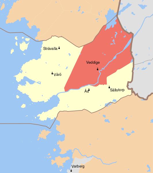
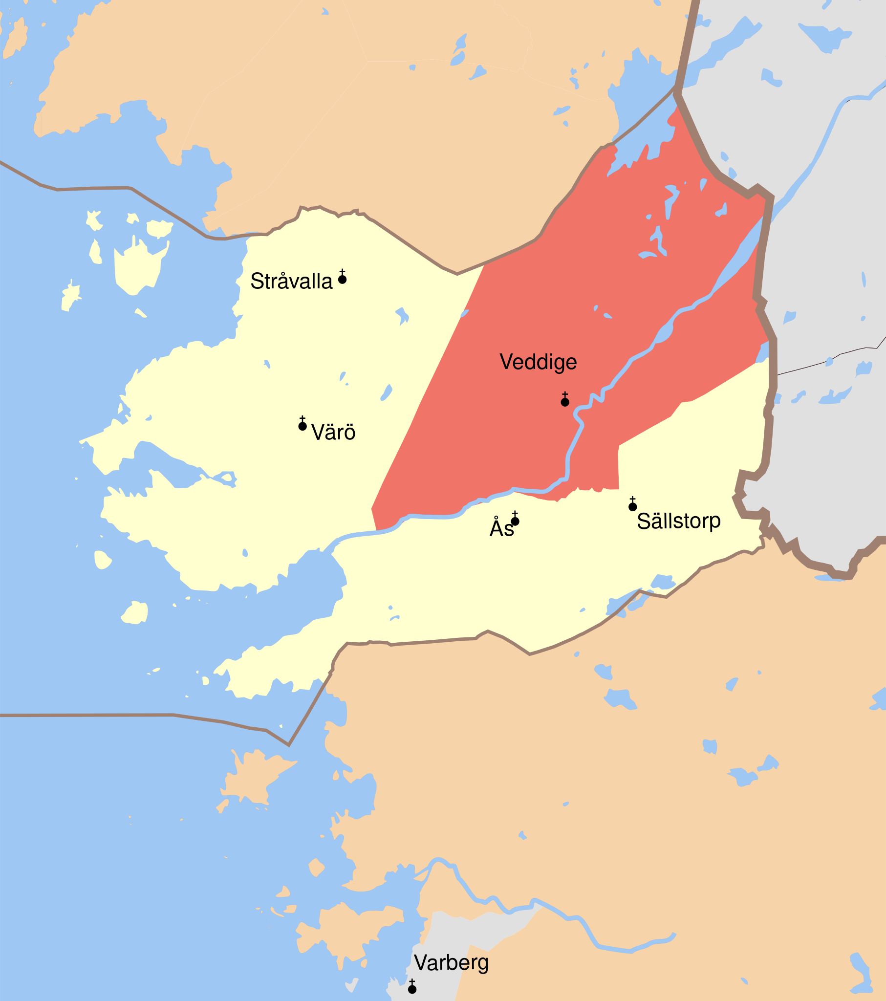
English: Map showing the borders of the civil parish of Veddige in the hundred of Viske, Halland County, Halland Region of Sweden. Circa 1850-1900.
|
| ⧼wm-license-information-date⧽ | 2010-09-05 17:42 (UTC) |
| ⧼wm-license-information-source⧽ | |
| ⧼wm-license-information-author⧽ |
|
| [This is a retouched picture, which means that it has been digitally altered from its original version. Modifications: Combined maps and cut out hundred of Vilske and marked Veddige parish. The original can be viewed here: GS_Särö.svg. Modifications made by Edaen.] Error: {{Lang}}: text has italic markup (help)
|
|
|
هذا الملفُّ مُرخَّص بموجب رخصة المشاع الإبداعي نسبة المُصنَّف إِلى مؤلفه - المشاركة بالمثل 3.0 العامة. |
قالب:Original upload log
This image is a derivative work of the following images:
- File:GS_Kungsbacka.svg licensed with Cc-by-3.0
- 2010-09-04T18:53:25Z Edaen 5950x4438 (719413 Bytes) {{Information |Description={{en|1=Map showing borders of parishes and hundreds in the vicinity of Kungsbacka, based on information from map by Topografiska Corpsen. '''Kongsbacka''' Geogr. längden är räknad från Stockhol
- File:GS_Varberg.svg licensed with Cc-by-3.0
- 2010-09-04T18:56:30Z Edaen 5963x4432 (612790 Bytes) {{Information |Description={{en|1=Map showing borders of parishes and hundreds in the vicinity of Varberg, based on information from map by Topografiska Corpsen. '''Warberg''' Grav. af Braese, Wennersten och Pettersson. Top
- File:GS_Särö.svg licensed with Cc-by-3.0
- 2010-09-05T16:52:47Z Edaen 5942x4388 (241265 Bytes) {{Information |Description={{en|1=Map showing borders of parishes and hundreds in the vicinity of Gothenburg, based on information from map by Topografiska Corpsen. '''Särö''' Grav. af G. Zintl. Topografiska Corpsens kart
تاريخ الملف
اضغط على زمن/تاريخ لرؤية الملف كما بدا في هذا الزمن.
| زمن/تاريخ | صورة مصغرة | الأبعاد | مستخدم | تعليق | |
|---|---|---|---|---|---|
| حالي | ★ مراجعة معتمدة 11:57، 11 أكتوبر 2023 | | 2٬612 × 2٬950 (1٫14 ميجابايت) | Pastakhov (نقاش | مساهمات) | Upload https://upload.wikimedia.org/wikipedia/commons/c/ca/Viske_Veddige.svg |
لا يمكنك استبدال هذا الملف.
وصلات
لا يوجد صفحات تصل لهذه الصورة.