ملف:Vettones cities location map-es.svg

حجم معاينة PNG لذلك الملف ذي الامتداد SVG: 600 × 600 بكسل. البعد الآخر: 2٬048 × 2٬048 بكسل.
الملف الأصلي (ملف SVG، أبعاده 1٬900 × 1٬900 بكسل، حجم الملف: 1٫96 ميجابايت)
وصف قصير
| ⧼wm-license-information-description⧽ |
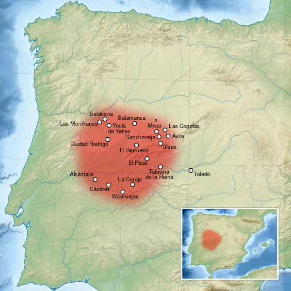
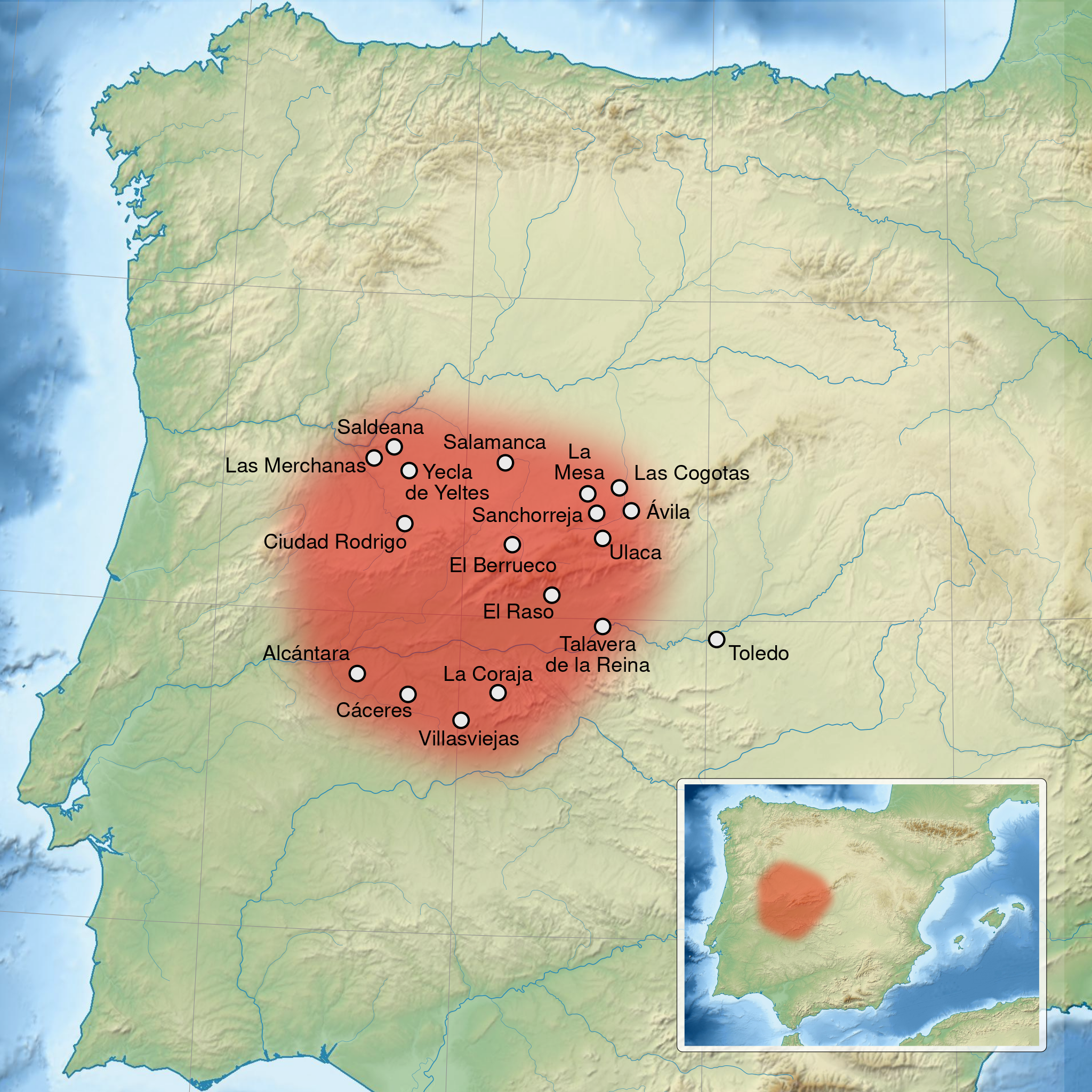
Español: Mapa del territorio y principales ciudades de los Vetones en la península Ibérica. English: Map of Vettones main cities and territory, in the Iberian Peninsula. Translation to spanish language of the french map File:Vettones cities location map-fr.svg (Toledo and Salamanca instead of Toléde, Salamanque) and small corrections to toponyms (Ulaca instead of Ucala, Yecla de Yeltes instead of Yecta) and locations. Français : Carte du territoire et des principales cités du peuple des Vettons, dans la péninsule Ibérique.
|
| ⧼wm-license-information-date⧽ | |
| ⧼wm-license-information-source⧽ | قالب:Derived from by Sémhur |
| ⧼wm-license-information-author⧽ | Asqueladd |
| ⧼wm-license-information-other-versions⧽ |
|
ترخيص
|
|
هذا الملفُّ مُرخَّص بموجب رخصة المشاع الإبداعي نسبة المُصنَّف إِلى مؤلفه - المشاركة بالمثل 3.0 العامة. |
تاريخ الملف
اضغط على زمن/تاريخ لرؤية الملف كما بدا في هذا الزمن.
| زمن/تاريخ | صورة مصغرة | الأبعاد | مستخدم | تعليق | |
|---|---|---|---|---|---|
| حالي | ★ مراجعة معتمدة 18:23، 10 أكتوبر 2023 | | 1٬900 × 1٬900 (1٫96 ميجابايت) | Pastakhov (نقاش | مساهمات) | Upload https://upload.wikimedia.org/wikipedia/commons/f/f2/Vettones_cities_location_map-es.svg |
لا يمكنك استبدال هذا الملف.
وصلات
لا يوجد صفحات تصل لهذه الصورة.