ملف:Utrecht hill ridge netherlands.svg

حجم معاينة PNG لذلك الملف ذي الامتداد SVG: 480 × 599 بكسل. البعد الآخر: 1٬642 × 2٬048 بكسل.
الملف الأصلي (ملف SVG، أبعاده 485 × 605 بكسل، حجم الملف: 24 كيلوبايت)
وصف قصير
| ⧼wm-license-information-description⧽ |
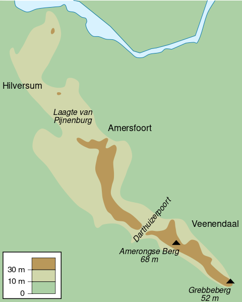
English: Map of the Utrecht Hill Ridge, a chain of hills located largely in the province of Utrecht, the Netherlands. The map shows the 10 m and 30 m contour lines, the two main peaks and the general location of several towns in the area.
(Dutch) |
| ⧼wm-license-information-date⧽ | 2010 |
| ⧼wm-license-information-source⧽ | ⧼Wm-license-own-work⧽ |
| ⧼wm-license-information-author⧽ | DennisM |
ترخيص
تاريخ الملف
اضغط على زمن/تاريخ لرؤية الملف كما بدا في هذا الزمن.
| زمن/تاريخ | صورة مصغرة | الأبعاد | مستخدم | تعليق | |
|---|---|---|---|---|---|
| حالي | ★ مراجعة معتمدة 02:58، 13 أكتوبر 2023 | | 485 × 605 (24 كيلوبايت) | Pastakhov (نقاش | مساهمات) | Upload https://upload.wikimedia.org/wikipedia/commons/a/a5/Utrecht_hill_ridge_netherlands.svg |
لا يمكنك استبدال هذا الملف.
وصلات
لا يوجد صفحات تصل لهذه الصورة.