ملف:Upper West Ghana districts.png
حجم هذه المعاينة: 776 × 600 بكسل. البعد الآخر: 1٬056 × 816 بكسل.
الملف الأصلي (1٬056 × 816 بكسل حجم الملف: 35 كيلوبايت، نوع MIME: image/png)
وصف قصير
| ⧼wm-license-information-description⧽ |
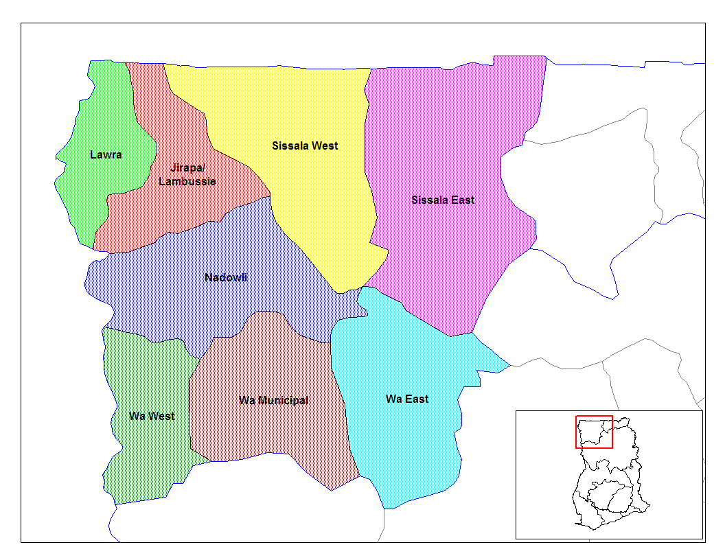
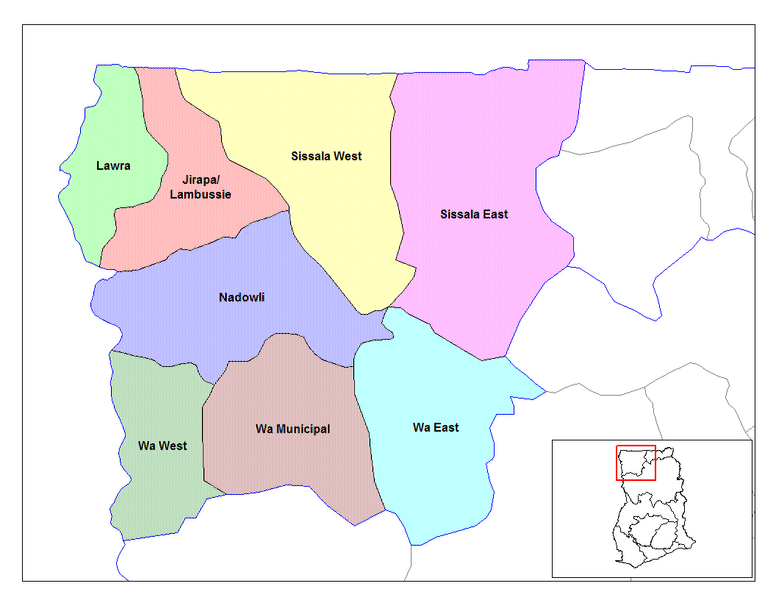
English: Map of the districts of the Upper East region of Ghana. Created by Rarelibra for public domain use. Created using MapInfo Professional v7.5 and various mapping resources.
|
| ⧼wm-license-information-date⧽ | قالب:Original upload date |
| ⧼wm-license-information-source⧽ | ⧼Wm-license-own-work⧽ |
| ⧼wm-license-information-author⧽ | User:Rarelibra |
ترخيص
قالب:Original upload log
- (del) (cur) 07:52, 5 March 2006 . . Rarelibra (Talk | contribs) . . 1056x816 (33,321 bytes) (Map of the districts of the Upper East region of Ghana. Created by Rarelibra for public domain use. Created using MapInfo Professional v7.5 and various mapping resources.)
تاريخ الملف
اضغط على زمن/تاريخ لرؤية الملف كما بدا في هذا الزمن.
| زمن/تاريخ | صورة مصغرة | الأبعاد | مستخدم | تعليق | |
|---|---|---|---|---|---|
| حالي | ★ مراجعة معتمدة 00:11، 8 ديسمبر 2023 | | 1٬056 × 816 (35 كيلوبايت) | Pastakhov (نقاش | مساهمات) | Upload https://upload.wikimedia.org/wikipedia/commons/f/fb/Upper_West_Ghana_districts.png |
لا يمكنك استبدال هذا الملف.
وصلات
لا يوجد صفحات تصل لهذه الصورة.