ملف:Upper River Lune - geograph.org.uk - 1201131.jpg
لا توجد دقة أعلى متوفرة.
Upper_River_Lune_-_geograph.org.uk_-_1201131.jpg (640 × 427 بكسل حجم الملف: 70 كيلوبايت، نوع MIME: image/jpeg)
وصف قصير
| ⧼wm-license-information-description⧽ |
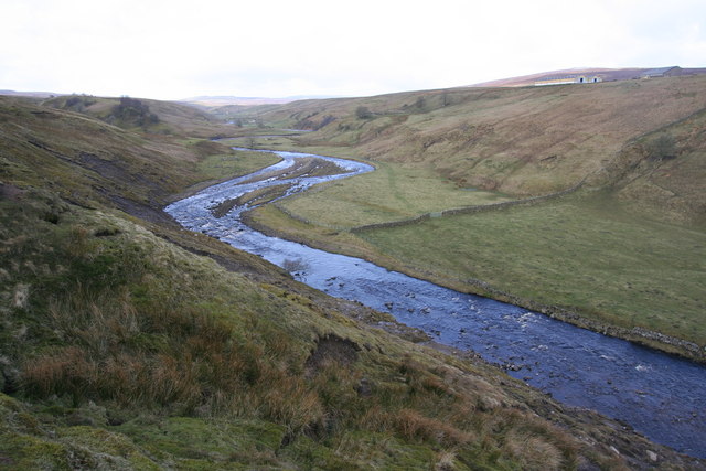
English: Upper River Lune Looking west up a series of meanders in the River Lune on its short course from it formation (by the confluence of Lune Head Beck and Long Grain) to its absorption in Selset reservoir half a kilometre behind the photographer.
|
| ⧼wm-license-information-date⧽ | 2009 |
| ⧼wm-license-information-source⧽ | From geograph.org.uk |
| ⧼wm-license-information-author⧽ | Andy Waddington |
| ⧼wm-license-cc-attribution⧽ (قالب:I18n/Credit line) |
Andy Waddington / Upper River Lune / |
54°35′02″N 2°10′35″W / 54.58385°N 2.1764°W قالب:Object location
_heading:270)
ترخيص
تاريخ الملف
اضغط على زمن/تاريخ لرؤية الملف كما بدا في هذا الزمن.
| زمن/تاريخ | صورة مصغرة | الأبعاد | مستخدم | تعليق | |
|---|---|---|---|---|---|
| حالي | ★ مراجعة معتمدة 21:04، 9 ديسمبر 2023 | | 640 × 427 (70 كيلوبايت) | Pastakhov (نقاش | مساهمات) | Upload https://upload.wikimedia.org/wikipedia/commons/e/e9/Upper_River_Lune_-_geograph.org.uk_-_1201131.jpg |
لا يمكنك استبدال هذا الملف.
وصلات
لا يوجد صفحات تصل لهذه الصورة.