ملف:University building, Drummond Street - geograph.org.uk - 1352882.jpg
لا توجد دقة أعلى متوفرة.
University_building,_Drummond_Street_-_geograph.org.uk_-_1352882.jpg (640 × 480 بكسل حجم الملف: 95 كيلوبايت، نوع MIME: image/jpeg)
وصف قصير
| ⧼wm-license-information-description⧽ |
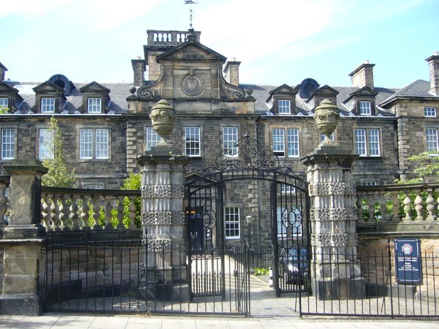
English: University building, Drummond Street Once part of the second Royal Infirmary, this building now houses the University's Geosciences Department.
|
| ⧼wm-license-information-date⧽ | 2009 |
| ⧼wm-license-information-source⧽ | From geograph.org.uk |
| ⧼wm-license-information-author⧽ | kim traynor |
55°56′53″N 3°10′58″W / 55.94808°N 3.1829°W قالب:Object location
_heading:337)
ترخيص
تاريخ الملف
اضغط على زمن/تاريخ لرؤية الملف كما بدا في هذا الزمن.
| زمن/تاريخ | صورة مصغرة | الأبعاد | مستخدم | تعليق | |
|---|---|---|---|---|---|
| حالي | ★ مراجعة معتمدة 05:59، 25 أكتوبر 2023 | | 640 × 480 (95 كيلوبايت) | Pastakhov (نقاش | مساهمات) | Upload https://upload.wikimedia.org/wikipedia/commons/3/3b/University_building%2C_Drummond_Street_-_geograph.org.uk_-_1352882.jpg |
لا يمكنك استبدال هذا الملف.
وصلات
لا يوجد صفحات تصل لهذه الصورة.