ملف:USGS geologic map St John USVI.png
حجم هذه المعاينة: 476 × 600 بكسل. البعد الآخر: 872 × 1٬099 بكسل.
الملف الأصلي (872 × 1٬099 بكسل حجم الملف: 217 كيلوبايت، نوع MIME: image/png)
وصف قصير
| ⧼wm-license-information-description⧽ |
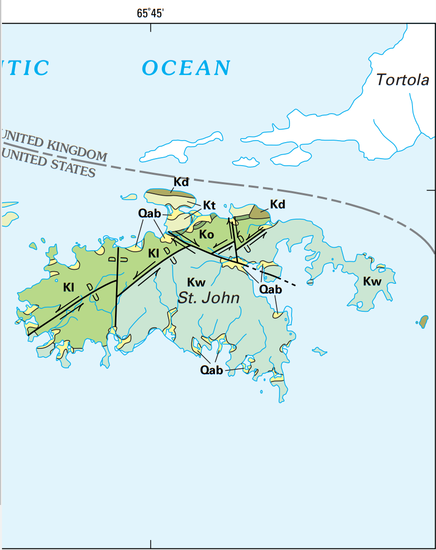
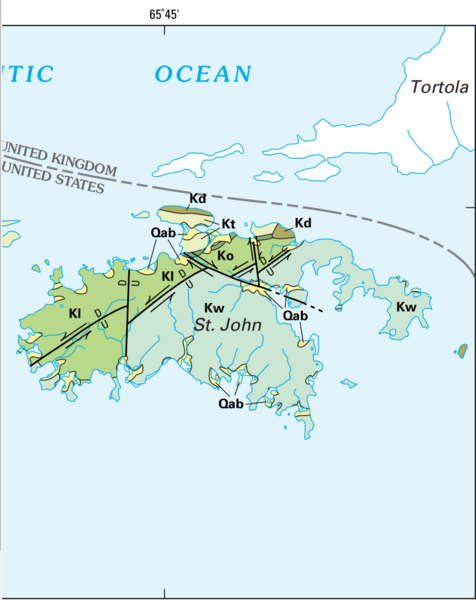
English: USGS geologic map St John USVI, where Qab is Quaternary alluvium and minor beach deposits, Kt is the Cretaceous Tutu Formation, Ko is the Cretaceous Outer Brass Formation, Kl is the Cretaceous Lousenhoj Formation, Kw is the Water Island Formation, and Kd are Cretaceous dioritic rocks, while U and D show the upthrown and downthrown portion of faults.
|
| ⧼wm-license-information-date⧽ | 2002 |
| ⧼wm-license-information-source⧽ | Geology and Hydrogeology of the Caribbean Islands Aquifer System of the Commonwealth of Puerto Rico and the U.S. Virgin Islands, USGS Professional Paper 1419, https://pubs.usgs.gov/pp/pp1419/pdf/BOOK.PDF |
| ⧼wm-license-information-author⧽ | ROBERT A. RENKEN, W.C. WARD, I.P. GILL, FERNANDO GÓMEZ-GÓMEZ, JESÚS RODRÍGUEZ-MARTÍNEZ |
ترخيص
تاريخ الملف
اضغط على زمن/تاريخ لرؤية الملف كما بدا في هذا الزمن.
| زمن/تاريخ | صورة مصغرة | الأبعاد | مستخدم | تعليق | |
|---|---|---|---|---|---|
| حالي | ★ مراجعة معتمدة 03:17، 2 ديسمبر 2023 | | 872 × 1٬099 (217 كيلوبايت) | Pastakhov (نقاش | مساهمات) | Upload https://upload.wikimedia.org/wikipedia/commons/1/19/USGS_geologic_map_St_John_USVI.png |
لا يمكنك استبدال هذا الملف.
وصلات
لا يوجد صفحات تصل لهذه الصورة.