ملف:Tummel Bridge power station - geograph.org.uk - 751568.jpg
لا توجد دقة أعلى متوفرة.
Tummel_Bridge_power_station_-_geograph.org.uk_-_751568.jpg (640 × 480 بكسل حجم الملف: 115 كيلوبايت، نوع MIME: image/jpeg)
وصف قصير
| ⧼wm-license-information-description⧽ |
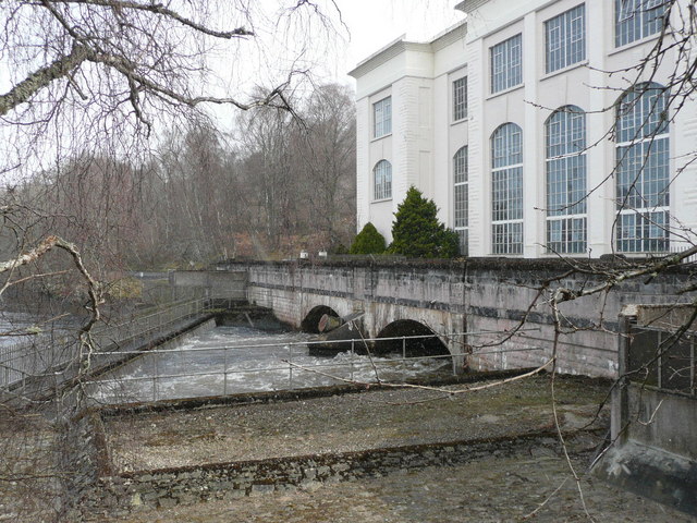
English: Tummel Bridge power station Its potential energy converted to electricity the water that was diverted from the River Tummel at Dunalastair, along the aqueduct and down the huge pipes now rejoins the river.
|
| ⧼wm-license-information-date⧽ | 2008 |
| ⧼wm-license-information-source⧽ | From geograph.org.uk |
| ⧼wm-license-information-author⧽ | Russel Wills |
| ⧼wm-license-cc-attribution⧽ (قالب:I18n/Credit line) |
Russel Wills / Tummel Bridge power station / |
56°42′25″N 4°01′20″W / 56.70685°N 4.0221°W قالب:Object location
_heading:112)
ترخيص
تاريخ الملف
اضغط على زمن/تاريخ لرؤية الملف كما بدا في هذا الزمن.
| زمن/تاريخ | صورة مصغرة | الأبعاد | مستخدم | تعليق | |
|---|---|---|---|---|---|
| حالي | ★ مراجعة معتمدة 18:16، 27 أكتوبر 2023 | | 640 × 480 (115 كيلوبايت) | Pastakhov (نقاش | مساهمات) | Upload https://upload.wikimedia.org/wikipedia/commons/a/ae/Tummel_Bridge_power_station_-_geograph.org.uk_-_751568.jpg |
لا يمكنك استبدال هذا الملف.
وصلات
لا يوجد صفحات تصل لهذه الصورة.