ملف:Troy, New York Map.png
حجم هذه المعاينة: 600 × 600 بكسل. البعد الآخر: 1٬000 × 1٬000 بكسل.
الملف الأصلي (1٬000 × 1٬000 بكسل حجم الملف: 472 كيلوبايت، نوع MIME: image/png)
وصف قصير
| ⧼wm-license-information-description⧽ |
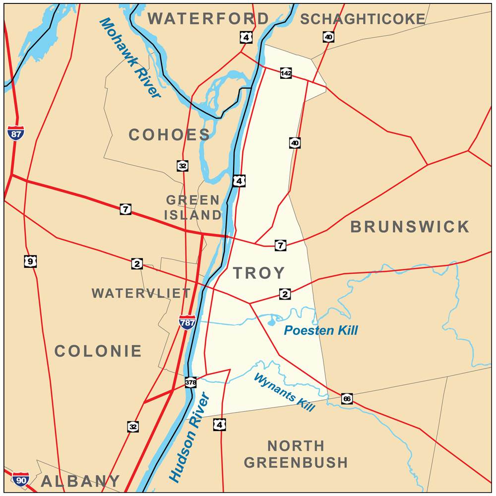
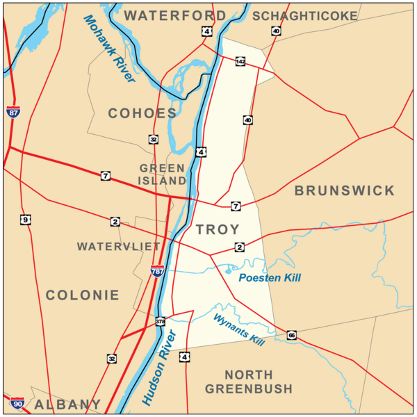
Map of Troy, New York, United States. |
| ⧼wm-license-information-date⧽ | 2010 |
| ⧼wm-license-information-source⧽ | ⧼Wm-license-own-work⧽. Township and county boundaries from the U.S. Census Bureau [1]; Rivers from the National Hydrography Dataset [2]; Roads from the National Atlas [3]. |
| ⧼wm-license-information-author⧽ | Kmusser |
| ⧼wm-license-information-other-versions⧽ |
ترخيص
|
تاريخ الملف
اضغط على زمن/تاريخ لرؤية الملف كما بدا في هذا الزمن.
| زمن/تاريخ | صورة مصغرة | الأبعاد | مستخدم | تعليق | |
|---|---|---|---|---|---|
| حالي | ★ مراجعة معتمدة 21:23، 1 نوفمبر 2023 | | 1٬000 × 1٬000 (472 كيلوبايت) | Pastakhov (نقاش | مساهمات) | Upload https://upload.wikimedia.org/wikipedia/commons/6/63/Troy%2C_New_York_Map.png |
لا يمكنك استبدال هذا الملف.
وصلات
لا يوجد صفحات تصل لهذه الصورة.