ملف:Trent, St Andrew's Church - geograph.org.uk - 88714.jpg
حجم هذه المعاينة: 440 × 599 بكسل. البعد الآخر: 451 × 614 بكسل.
الملف الأصلي (451 × 614 بكسل حجم الملف: 136 كيلوبايت، نوع MIME: image/jpeg)
وصف قصير
| ⧼wm-license-information-description⧽ |
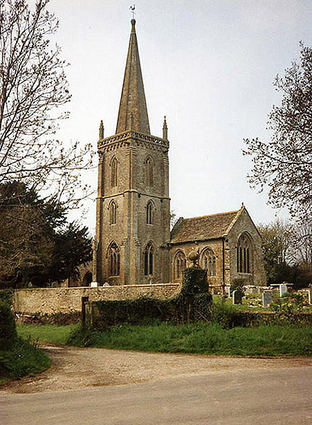
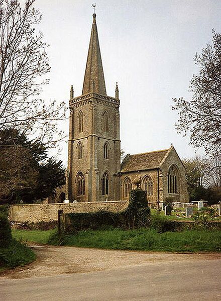
English: Trent: St Andrews Church. After the Battle of Worcester in September 1651 the future King Charles II escaped first north and then south and south east. He stayed hidden awhile in the nearby Manor House in Trent village before eventually getting away to Fecamp in France via Shoreham in October of that year
|
| ⧼wm-license-information-date⧽ | قالب:Taken on |
| ⧼wm-license-information-source⧽ | From geograph.org.uk |
| ⧼wm-license-information-author⧽ | Martin Bodman |
50°57′50″N 2°35′10″W / 50.9640°N 2.586°W قالب:Object location
)
ترخيص
تاريخ الملف
اضغط على زمن/تاريخ لرؤية الملف كما بدا في هذا الزمن.
| زمن/تاريخ | صورة مصغرة | الأبعاد | مستخدم | تعليق | |
|---|---|---|---|---|---|
| حالي | ★ مراجعة معتمدة 19:12، 30 نوفمبر 2023 | | 451 × 614 (136 كيلوبايت) | Pastakhov (نقاش | مساهمات) | Upload https://upload.wikimedia.org/wikipedia/commons/b/b1/Trent%2C_St_Andrew%27s_Church_-_geograph.org.uk_-_88714.jpg |
لا يمكنك استبدال هذا الملف.
وصلات
لا يوجد صفحات تصل لهذه الصورة.