ملف:Tramlink map 2017.png

حجم هذه المعاينة: 800 × 439 بكسل. البعدان الآخران: 2٬560 × 1٬406 بكسل | 5٬526 × 3٬035 بكسل.
الملف الأصلي (5٬526 × 3٬035 بكسل حجم الملف: 1٫31 ميجابايت، نوع MIME: image/png)
وصف قصير
| ⧼wm-license-information-description⧽ |
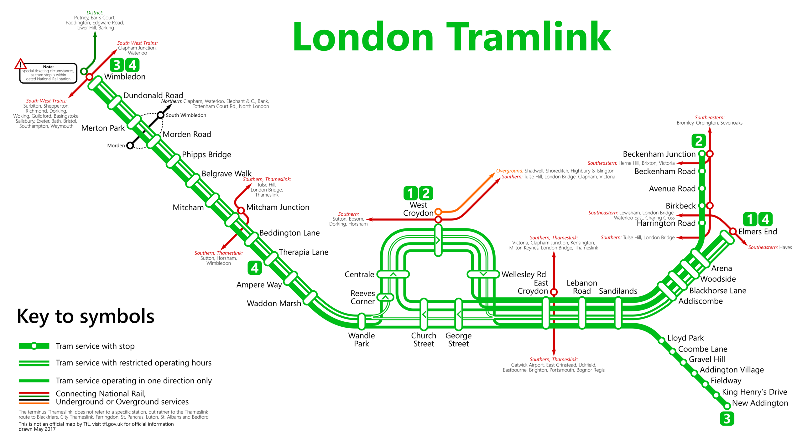
Deutsch: Karte der Londoner Straßenbahnen, Stand 2017
English: Map of the London tramlink as of 2017
|
| ⧼wm-license-information-date⧽ | 2016 |
| ⧼wm-license-information-source⧽ | ⧼Wm-license-own-work⧽ |
| ⧼wm-license-information-author⧽ | Metrophil |
ترخيص
|
تاريخ الملف
اضغط على زمن/تاريخ لرؤية الملف كما بدا في هذا الزمن.
| زمن/تاريخ | صورة مصغرة | الأبعاد | مستخدم | تعليق | |
|---|---|---|---|---|---|
| حالي | ★ مراجعة معتمدة 11:45، 14 أكتوبر 2023 | | 5٬526 × 3٬035 (1٫31 ميجابايت) | Pastakhov (نقاش | مساهمات) | Upload https://upload.wikimedia.org/wikipedia/commons/e/e1/Tramlink_map_2017.png |
لا يمكنك استبدال هذا الملف.
وصلات
لا يوجد صفحات تصل لهذه الصورة.