ملف:Trópico de Cáncer en México - Carretera 83 (Vía Corta) Zaragoza-Victoria, Km 27+800.jpg
حجم هذه المعاينة: 800 × 600 بكسل. البعدان الآخران: 2٬560 × 1٬920 بكسل | 3٬264 × 2٬448 بكسل.
الملف الأصلي (3٬264 × 2٬448 بكسل حجم الملف: 2٫33 ميجابايت، نوع MIME: image/jpeg)
وصف قصير
| ⧼wm-license-information-description⧽ |
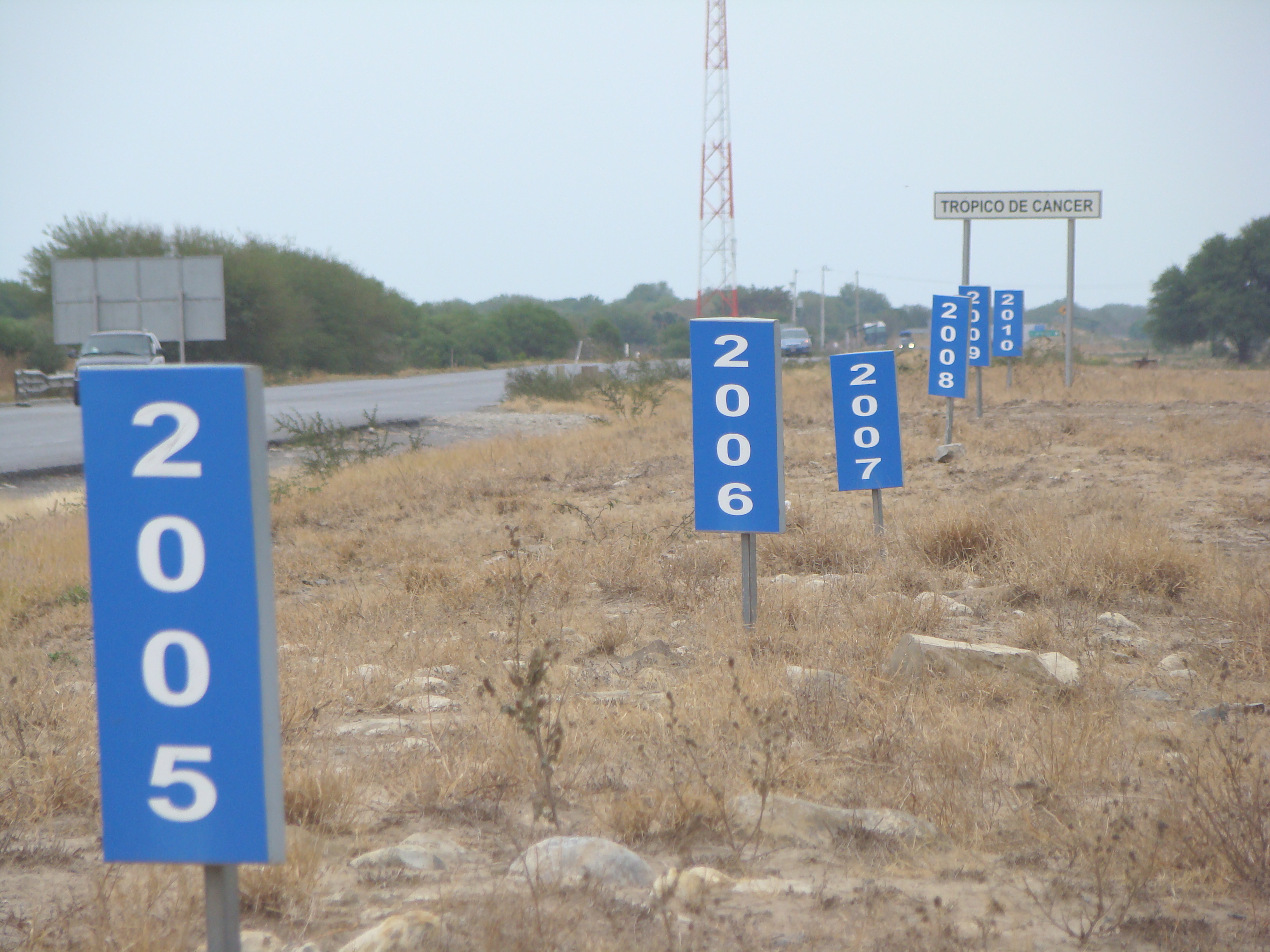
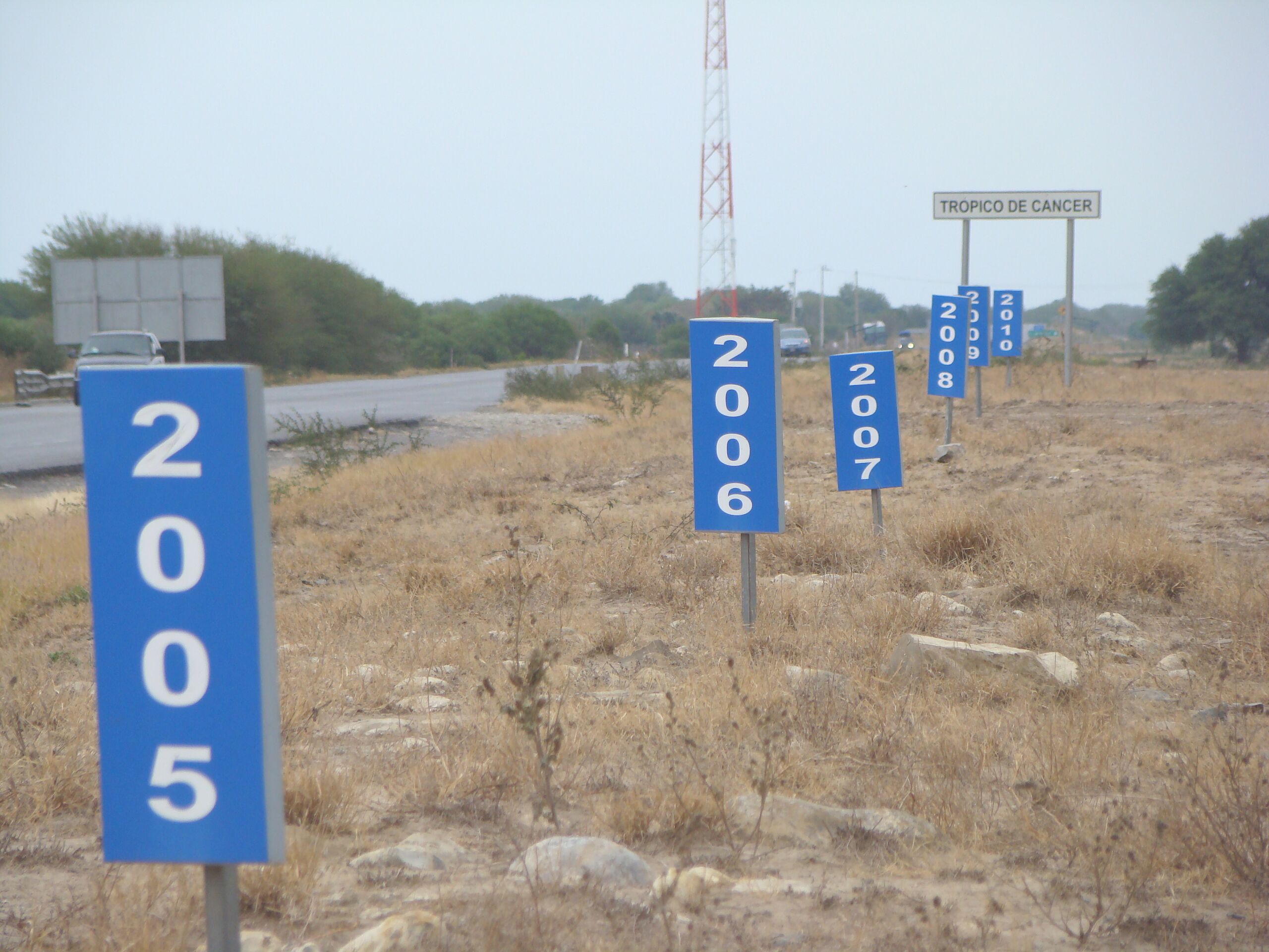
Español: De todos los cruces del Trópico de Cáncer con las carreteras federales mexicanas, éste es el único lugar donde la línea está marcada con absoluta precisión y además se puede visualizar el desplazamiento anual entre los años 2005 y 2010.
English: Of all crossings of the Tropic of Cancer with Mexican federal highways, this is the only place where the line is marked with precision and history of the annual movement since 2005.
Publicada originalmente en Trópico en movimiento (Archived 22 مايو 2011 at the Wayback Machine) |
| ⧼wm-license-information-date⧽ | 2010 |
| ⧼wm-license-information-source⧽ | ⧼Wm-license-own-work⧽ |
| ⧼wm-license-information-author⧽ | Roberto González |
ترخيص
|

تاريخ الملف
اضغط على زمن/تاريخ لرؤية الملف كما بدا في هذا الزمن.
| زمن/تاريخ | صورة مصغرة | الأبعاد | مستخدم | تعليق | |
|---|---|---|---|---|---|
| حالي | ★ مراجعة معتمدة 12:15، 4 ديسمبر 2023 | | 3٬264 × 2٬448 (2٫33 ميجابايت) | Pastakhov (نقاش | مساهمات) | Upload https://upload.wikimedia.org/wikipedia/commons/b/b4/Tr%C3%B3pico_de_C%C3%A1ncer_en_M%C3%A9xico_-_Carretera_83_%28V%C3%ADa_Corta%29_Zaragoza-Victoria%2C_Km_27%2B800.jpg |
لا يمكنك استبدال هذا الملف.
وصلات
لا يوجد صفحات تصل لهذه الصورة.
_Zaragoza-Victoria,_Km_27%2B800.jpg&oldid=3690910)