ملف:Town of High River Best Aerial Photo.jpg
لا توجد دقة أعلى متوفرة.
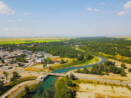
Town_of_High_River_Best_Aerial_Photo.jpg (500 × 375 بكسل حجم الملف: 76 كيلوبايت، نوع MIME: image/jpeg)
وصف قصير
| ⧼wm-license-information-description⧽ |
English: Photo of the Town of High River taken from above the downtown core, looking at the river & downtown.
|
| ⧼wm-license-information-date⧽ | 2017, {{time}} – invalid date format 49 (help) |
| ⧼wm-license-information-source⧽ | ⧼Wm-license-own-work⧽ |
| ⧼wm-license-information-author⧽ | Connorbrown22 |
50°35′04″N 113°52′25″W / 50.584435°N 113.873505°W This photo was taken in July 2017 and represents the current state of the town of high river & high river municipality after the flood recovery.
ترخيص
|
تاريخ الملف
اضغط على زمن/تاريخ لرؤية الملف كما بدا في هذا الزمن.
| زمن/تاريخ | صورة مصغرة | الأبعاد | مستخدم | تعليق | |
|---|---|---|---|---|---|
| حالي | ★ مراجعة معتمدة 13:05، 10 نوفمبر 2023 | | 500 × 375 (76 كيلوبايت) | Pastakhov (نقاش | مساهمات) | Upload https://upload.wikimedia.org/wikipedia/commons/b/b9/Town_of_High_River_Best_Aerial_Photo.jpg |
لا يمكنك استبدال هذا الملف.
وصلات
لا يوجد صفحات تصل لهذه الصورة.