ملف:Tour de France 1903 schema.png
حجم هذه المعاينة: 634 × 600 بكسل. البعد الآخر: 1٬188 × 1٬124 بكسل.
الملف الأصلي (1٬188 × 1٬124 بكسل حجم الملف: 722 كيلوبايت، نوع MIME: image/png)
وصف قصير
| ⧼wm-license-information-description⧽ |
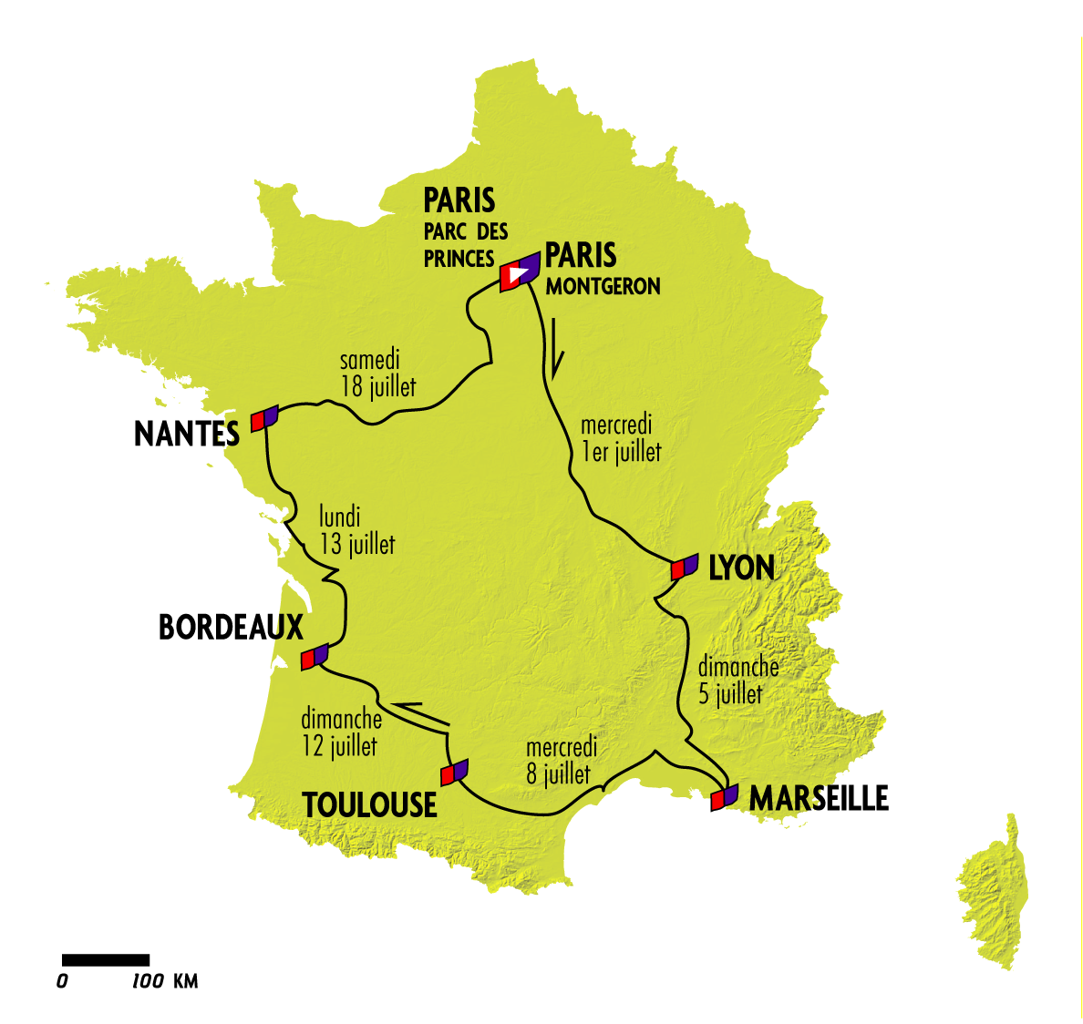
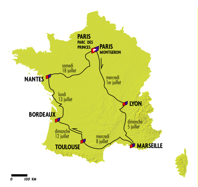
Français : Dans le style des publications officielles du Tour de France, cette carte figure un parcours assez précis formé sur SIG et les limites de la France en 1914 en ce qui concerne l'Alsace Lorraine
|
| ⧼wm-license-information-date⧽ | 2020 |
| ⧼wm-license-information-source⧽ | ⧼Wm-license-own-work⧽ |
| ⧼wm-license-information-author⧽ | Vincedchart |
ترخيص
|
تاريخ الملف
اضغط على زمن/تاريخ لرؤية الملف كما بدا في هذا الزمن.
| زمن/تاريخ | صورة مصغرة | الأبعاد | مستخدم | تعليق | |
|---|---|---|---|---|---|
| حالي | ★ مراجعة معتمدة 19:36، 14 أكتوبر 2023 | | 1٬188 × 1٬124 (722 كيلوبايت) | Pastakhov (نقاش | مساهمات) | Upload https://upload.wikimedia.org/wikipedia/commons/3/3a/Tour_de_France_1903_schema.png |
لا يمكنك استبدال هذا الملف.
وصلات
لا يوجد صفحات تصل لهذه الصورة.