ملف:Topographic map of the Seine basin (French png).png
حجم هذه المعاينة: 698 × 600 بكسل. البعدان الآخران: 2٬384 × 2٬048 بكسل | 3٬500 × 3٬007 بكسل.
الملف الأصلي (3٬500 × 3٬007 بكسل حجم الملف: 7٫71 ميجابايت، نوع MIME: image/png)
وصف قصير
| ⧼wm-license-information-description⧽ |
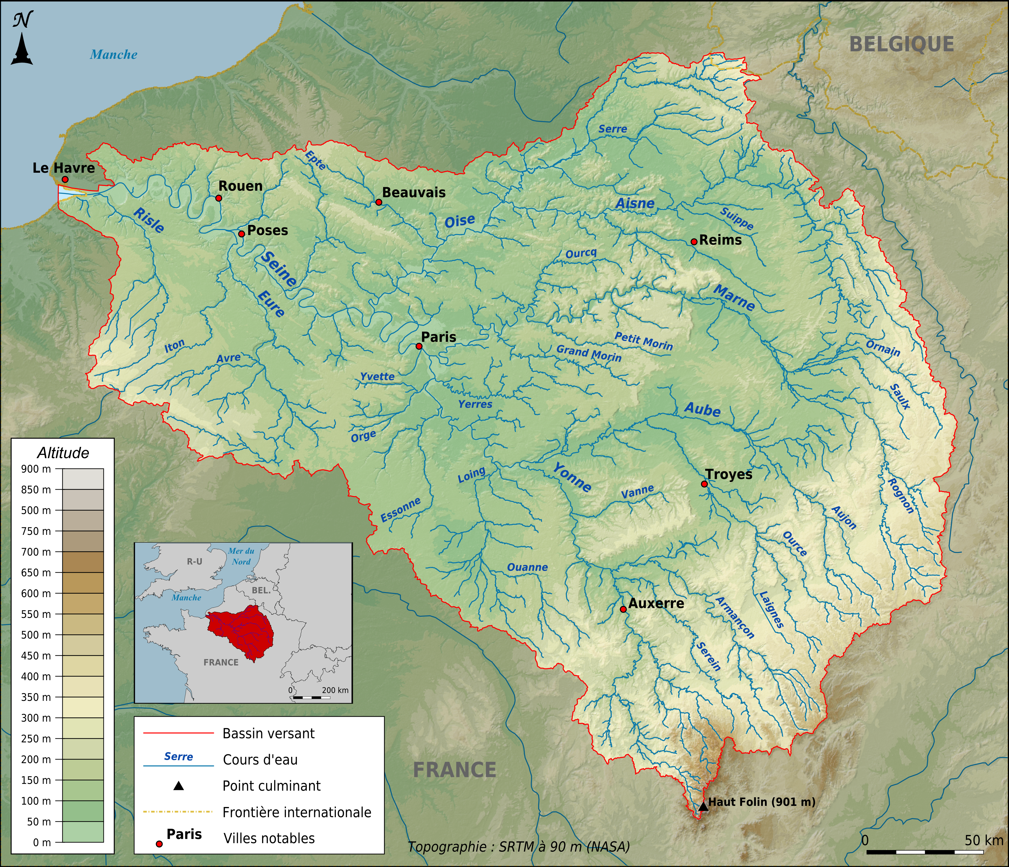
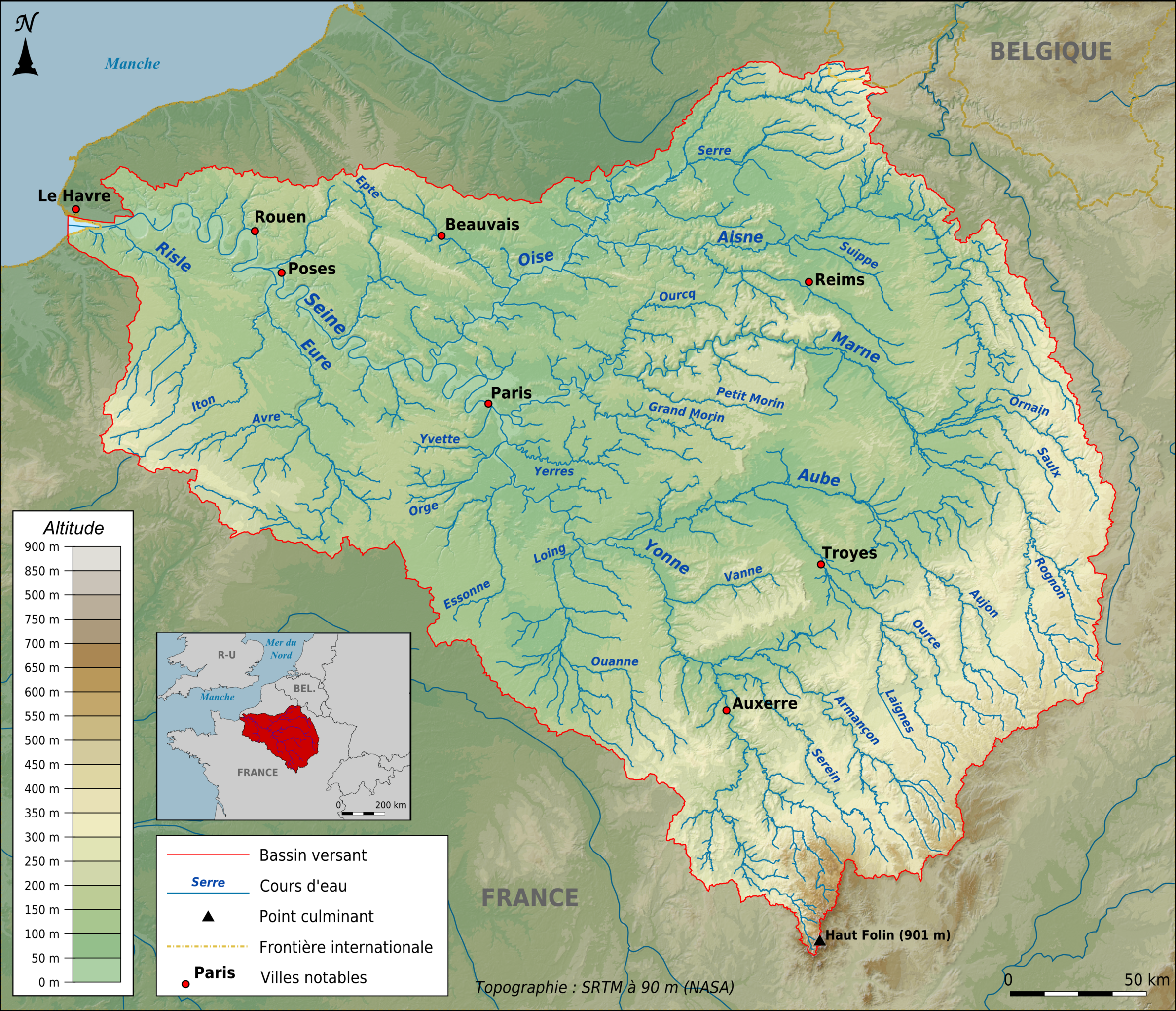
English: Topographic map of the Seine basin in French, in png format, Lambert 93 projection
Français : Carte topographique du bassin de la Seine en français, au format png, projection Lambert 93
Deutsch: Topografische Karte des hydrologischen Einzugsbereichs der Seine in französischer Sprache. Format: PNG Projektion: Lambert 93
|
| ⧼wm-license-information-date⧽ | 2012 |
| ⧼wm-license-information-source⧽ | ⧼Wm-license-own-work⧽;
|
| ⧼wm-license-information-author⧽ | Paul Passy (Chamois rouge) |
| ⧼wm-license-information-other-versions⧽ |
|
48°52′06″N 02°21′13″E / 48.86833°N 2.35361°E قالب:Atelier graphique carte
.png¶ms=48_52_06_N_02_21_13_E_scale:1000000)
ترخيص
|
تاريخ الملف
اضغط على زمن/تاريخ لرؤية الملف كما بدا في هذا الزمن.
| زمن/تاريخ | صورة مصغرة | الأبعاد | مستخدم | تعليق | |
|---|---|---|---|---|---|
| حالي | ★ مراجعة معتمدة 10:35، 26 يناير 2024 | | 3٬500 × 3٬007 (7٫71 ميجابايت) | Pastakhov (نقاش | مساهمات) | Upload https://upload.wikimedia.org/wikipedia/commons/d/d5/Topographic_map_of_the_Seine_basin_%28French_png%29.png |
لا يمكنك استبدال هذا الملف.
وصلات
لا يوجد صفحات تصل لهذه الصورة.
.png&oldid=3932550)