ملف:The main street, Monreith - geograph.org.uk - 214891.jpg
لا توجد دقة أعلى متوفرة.
The_main_street,_Monreith_-_geograph.org.uk_-_214891.jpg (640 × 480 بكسل حجم الملف: 84 كيلوبايت، نوع MIME: image/jpeg)
وصف قصير
| ⧼wm-license-information-description⧽ |
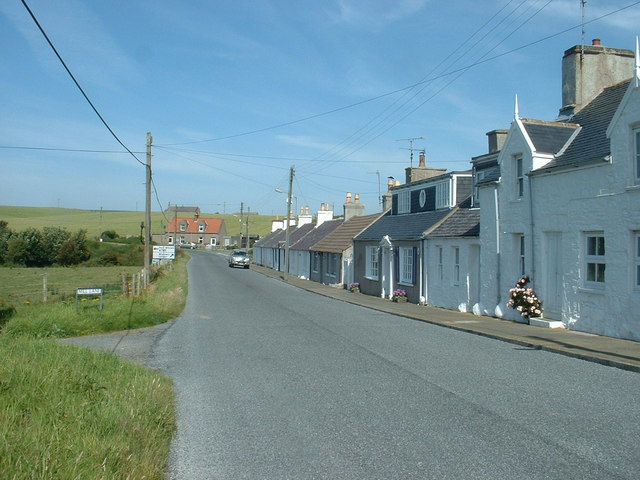
English: The main street, Monreith. Actually - the only street in Monreith. It is the A747 which runs from Glenluce, at the head of Luce Bay, to Whithorn at the end of the Machars peninsula.
|
| ⧼wm-license-information-date⧽ | 2006 |
| ⧼wm-license-information-source⧽ | From geograph.org.uk |
| ⧼wm-license-information-author⧽ | David Medcalf |
| ⧼wm-license-cc-attribution⧽ (قالب:I18n/Credit line) |
David Medcalf / The main street, Monreith / |
54°44′12″N 4°33′00″W / 54.7367°N 4.550°W قالب:Object location
_heading:292)
ترخيص
تاريخ الملف
اضغط على زمن/تاريخ لرؤية الملف كما بدا في هذا الزمن.
| زمن/تاريخ | صورة مصغرة | الأبعاد | مستخدم | تعليق | |
|---|---|---|---|---|---|
| حالي | ★ مراجعة معتمدة 07:01، 24 أكتوبر 2023 | | 640 × 480 (84 كيلوبايت) | Pastakhov (نقاش | مساهمات) | Upload https://upload.wikimedia.org/wikipedia/commons/3/36/The_main_street%2C_Monreith_-_geograph.org.uk_-_214891.jpg |
لا يمكنك استبدال هذا الملف.
وصلات
لا يوجد صفحات تصل لهذه الصورة.