ملف:The Arikara War, 1823.png
حجم هذه المعاينة: 800 × 527 بكسل. البعد الآخر: 1٬778 × 1٬171 بكسل.
الملف الأصلي (1٬778 × 1٬171 بكسل حجم الملف: 825 كيلوبايت، نوع MIME: image/png)
وصف قصير
| ⧼wm-license-information-description⧽ |
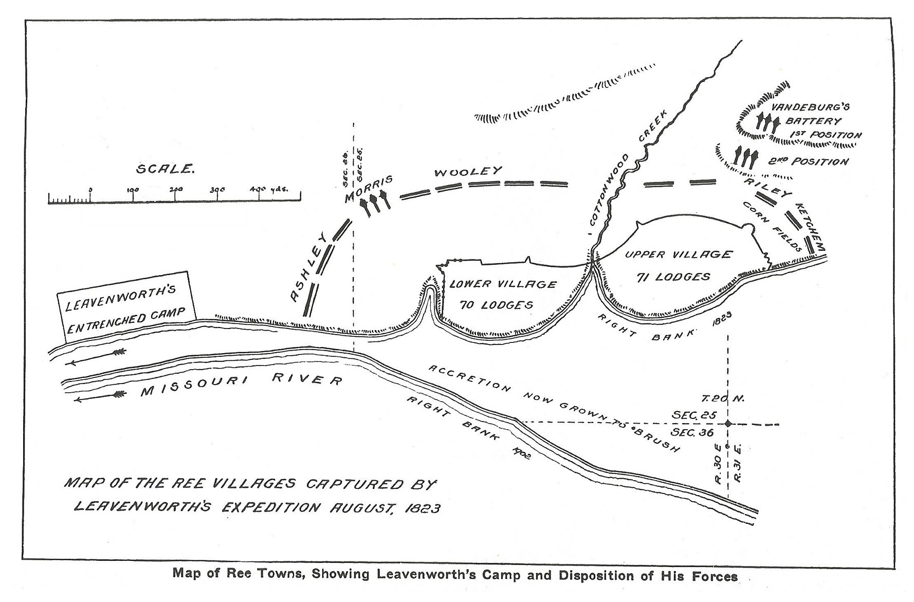
English: Map of the Arikara villages, the camp of the army and the position of the batteries
|
| ⧼wm-license-information-date⧽ | 1902 |
| ⧼wm-license-information-source⧽ | South Dakota Historical Collections, 1902 |
| ⧼wm-license-information-author⧽ | style="background: #E4E4E4; color: black; vertical-align: middle; text-align: center; " class="unknown table-unknown"|author |
North America, U.S., South Dakota
ترخيص
تاريخ الملف
اضغط على زمن/تاريخ لرؤية الملف كما بدا في هذا الزمن.
| زمن/تاريخ | صورة مصغرة | الأبعاد | مستخدم | تعليق | |
|---|---|---|---|---|---|
| حالي | ★ مراجعة معتمدة 21:58، 4 أكتوبر 2023 | | 1٬778 × 1٬171 (825 كيلوبايت) | Pastakhov (نقاش | مساهمات) | Upload https://upload.wikimedia.org/wikipedia/commons/f/f5/The_Arikara_War%2C_1823.png |
لا يمكنك استبدال هذا الملف.
وصلات
لا يوجد صفحات تصل لهذه الصورة.