ملف:Tabreux hydroraphic station.jpg

حجم هذه المعاينة: 399 × 599 بكسل. البعدان الآخران: 1٬365 × 2٬048 بكسل | 2٬695 × 4٬043 بكسل.
الملف الأصلي (2٬695 × 4٬043 بكسل حجم الملف: 9٫4 ميجابايت، نوع MIME: image/jpeg)
وصف قصير
| ⧼wm-license-information-description⧽ |
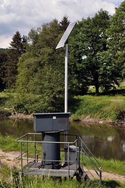
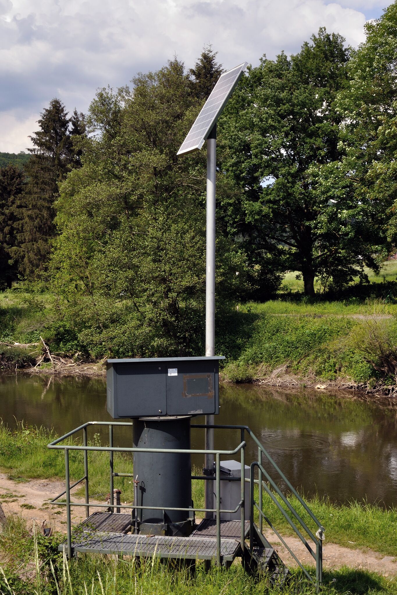
English: The hydrographic station situated in Tabreux, Hamoir, Wallonia, Belgium. Français : La station hydrographique située à Tabreux, Hamoir, Wallonia, Belgium. Elle mesure notamment la hauteur et le débit de l'Ourthe à cet endroit.
|
| ⧼wm-license-information-date⧽ | 2018, 08:21 UTC+16:00 [refresh] |
| ⧼wm-license-information-source⧽ | ⧼Wm-license-own-work⧽ |
| ⧼wm-license-information-author⧽ | Pierre-Jacques DESPA |
50°26′17″N 5°32′06″E / 50.43800058°N 5.53501457°E
ترخيص
|
تاريخ الملف
اضغط على زمن/تاريخ لرؤية الملف كما بدا في هذا الزمن.
| زمن/تاريخ | صورة مصغرة | الأبعاد | مستخدم | تعليق | |
|---|---|---|---|---|---|
| حالي | ★ مراجعة معتمدة 03:56، 28 نوفمبر 2023 | | 2٬695 × 4٬043 (9٫4 ميجابايت) | Pastakhov (نقاش | مساهمات) | Upload https://upload.wikimedia.org/wikipedia/commons/6/61/Tabreux_hydroraphic_station.jpg |
لا يمكنك استبدال هذا الملف.
وصلات
لا يوجد صفحات تصل لهذه الصورة.
معلومات الصورة (ميتا)
تصنيفات:
- Pages using gadget WikiMiniAtlas
- Self-published work
- Ourthe in Hamoir
- Hydrographic station Tabreux
- 2018 in Hamoir
- Taken with Nikon D90
- Spring 2018 in Belgium
- Quality images by PJDespa
- Quality images of Hamoir
- Valued images of Belgium
- Valued Image by PJDespa
- May 2018 in Wallonia
- Belgium photographs taken on 2018-05-21