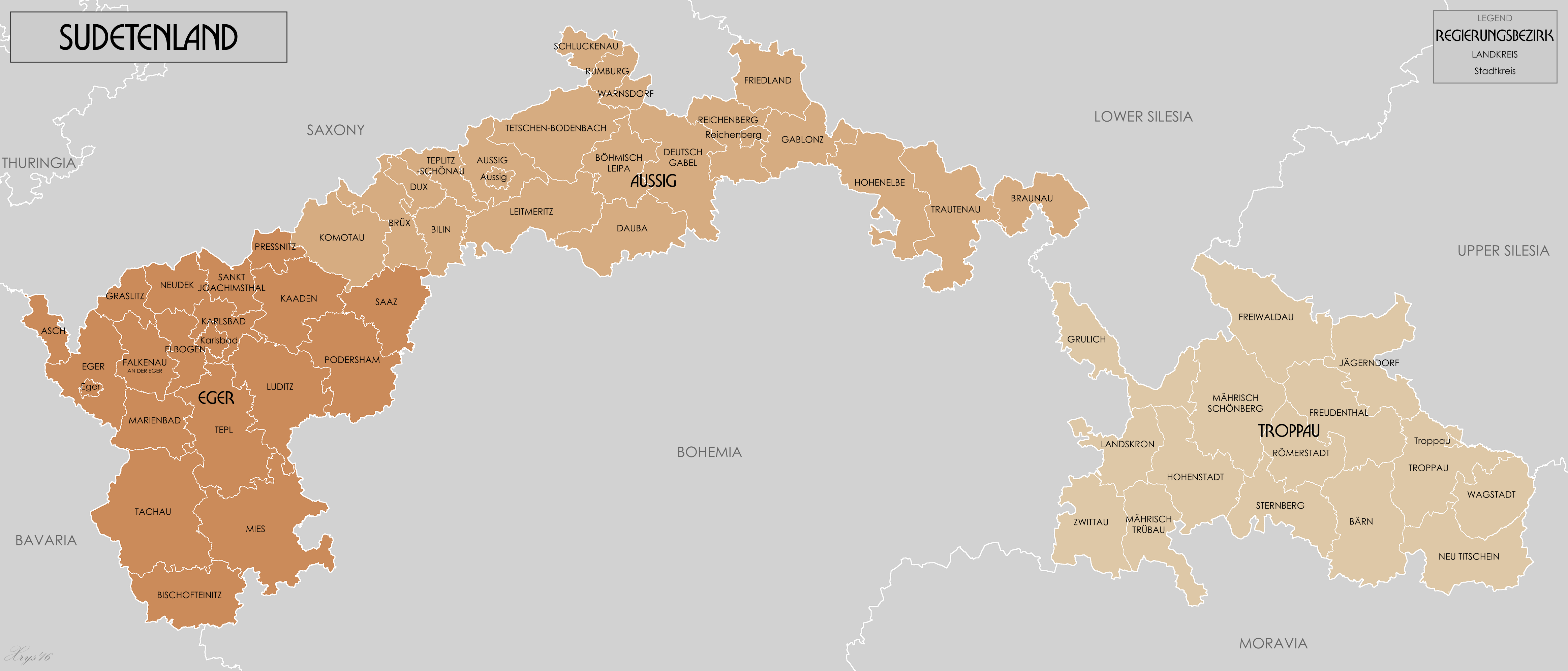
ملف:Sudetenland Reichsgau 1944.png
حجم هذه المعاينة: 799 × 342 بكسل. البعد الآخر: 4٬653 × 1٬992 بكسل.
الملف الأصلي (4٬653 × 1٬992 بكسل حجم الملف: 1٫15 ميجابايت، نوع MIME: image/png)
وصف قصير
| ⧼wm-license-information-description⧽ |
English: Administrative map of Reichsgau Sudetenland in 1944. Source
GIS Data digitised from Karte des Deutschen Reiches 1:100 000 and Karte von Mitteleuropa 1:300k. Some source maps from WIG (www.mapywig.org).
|
| ⧼wm-license-information-date⧽ | 2014, 2:51 am UTC+11:00 [refresh] |
| ⧼wm-license-information-source⧽ | ⧼Wm-license-own-work⧽ |
| ⧼wm-license-information-author⧽ | XrysD |
ترخيص
|
تاريخ الملف
اضغط على زمن/تاريخ لرؤية الملف كما بدا في هذا الزمن.
| زمن/تاريخ | صورة مصغرة | الأبعاد | مستخدم | تعليق | |
|---|---|---|---|---|---|
| حالي | ★ مراجعة معتمدة 18:53، 19 يناير 2024 | | 4٬653 × 1٬992 (1٫15 ميجابايت) | Pastakhov (نقاش | مساهمات) | Upload https://upload.wikimedia.org/wikipedia/commons/4/41/Sudetenland_Reichsgau_1944.png |
لا يمكنك استبدال هذا الملف.
وصلات
لا يوجد صفحات تصل لهذه الصورة.