ملف:St Mary's Burford. - geograph.org.uk - 88476.jpg
لا توجد دقة أعلى متوفرة.
St_Mary's_Burford._-_geograph.org.uk_-_88476.jpg (640 × 480 بكسل حجم الملف: 82 كيلوبايت، نوع MIME: image/jpeg)
وصف قصير
| ⧼wm-license-information-description⧽ |
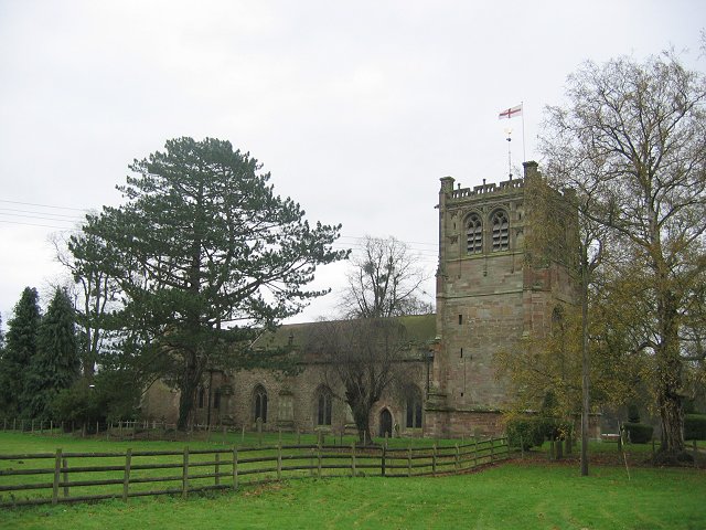
English: St Mary's Burford. Today Burford is the industrial "suburb" of Tenbury, one of the few places in South Shropshire that has escaped the planner's straight jacket. The original building with a very large church was some distance upstream along the Teme, and is now home to a renowned garden centre.
This is the very southern tip of Shropshire, a long way south of Woore, just outside Stoke on Trent - at the other end - or the North Wales communities around Oswestry.
|
| ⧼wm-license-information-date⧽ | 2005 |
| ⧼wm-license-information-source⧽ | From geograph.org.uk |
| ⧼wm-license-information-author⧽ | Richard Webb |
| ⧼wm-license-cc-attribution⧽ (قالب:I18n/Credit line) |
Richard Webb / St Mary's Burford. / |
ترخيص
تاريخ الملف
اضغط على زمن/تاريخ لرؤية الملف كما بدا في هذا الزمن.
| زمن/تاريخ | صورة مصغرة | الأبعاد | مستخدم | تعليق | |
|---|---|---|---|---|---|
| حالي | ★ مراجعة معتمدة 21:52، 16 أكتوبر 2023 | | 640 × 480 (82 كيلوبايت) | Pastakhov (نقاش | مساهمات) | Upload https://upload.wikimedia.org/wikipedia/commons/3/3b/St_Mary%27s_Burford._-_geograph.org.uk_-_88476.jpg |
لا يمكنك استبدال هذا الملف.
وصلات
لا يوجد صفحات تصل لهذه الصورة.