ملف:St Martin's Church - geograph.org.uk - 1754118.jpg
حجم هذه المعاينة: 450 × 600 بكسل. البعد الآخر: 480 × 640 بكسل.
الملف الأصلي (480 × 640 بكسل حجم الملف: 109 كيلوبايت، نوع MIME: image/jpeg)
وصف قصير
| ⧼wm-license-information-description⧽ |
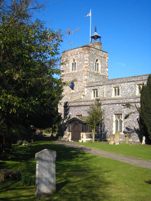
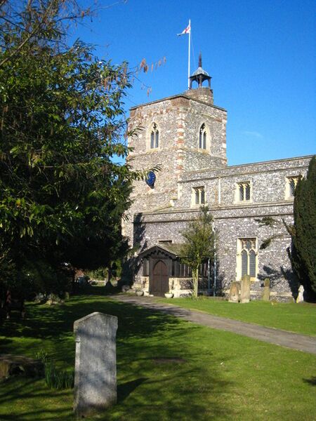
English: St Martin's Church West Drayton parish church, dating from the C13th. Grade II* listed https://historicengland.org.uk/listing/the-list/list-entry/1358325.
|
| ⧼wm-license-information-date⧽ | 2010 |
| ⧼wm-license-information-source⧽ | From geograph.org.uk |
| ⧼wm-license-information-author⧽ | Rod Allday |
| ⧼wm-license-cc-attribution⧽ (قالب:I18n/Credit line) |
Rod Allday / St Martin's Church / |
51°30′16″N 0°28′18″W / 51.50452°N 0.4716°W قالب:Object location
_heading:337)
ترخيص
تاريخ الملف
اضغط على زمن/تاريخ لرؤية الملف كما بدا في هذا الزمن.
| زمن/تاريخ | صورة مصغرة | الأبعاد | مستخدم | تعليق | |
|---|---|---|---|---|---|
| حالي | ★ مراجعة معتمدة 22:55، 8 ديسمبر 2023 | | 480 × 640 (109 كيلوبايت) | Pastakhov (نقاش | مساهمات) | Upload https://upload.wikimedia.org/wikipedia/commons/1/1e/St_Martin%27s_Church_-_geograph.org.uk_-_1754118.jpg |
لا يمكنك استبدال هذا الملف.
وصلات
لا يوجد صفحات تصل لهذه الصورة.