ملف:South Tarawa (map within Tarawa Atoll).png
لا توجد دقة أعلى متوفرة.
South_Tarawa_(map_within_Tarawa_Atoll).png (600 × 600 بكسل حجم الملف: 62 كيلوبايت، نوع MIME: image/png)
وصف قصير
| ⧼wm-license-information-description⧽ |
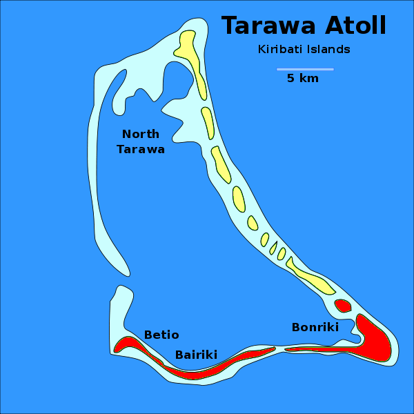
English: Locator map of the municipality of South Tarawa (shown in red) within the atoll of Tarawa, in Kiribati. The other municipality, North Tarawa, is shown in yellow.
|
| ⧼wm-license-information-date⧽ | 2011 |
| ⧼wm-license-information-source⧽ | Derived work from the File:Tarawa Atoll, Kiribati.svg, uploaded by Indolences |
| ⧼wm-license-information-author⧽ | Dэя-Бøяg |
| ⧼wm-license-information-other-versions⧽ |
|

ترخيص
|

تاريخ الملف
اضغط على زمن/تاريخ لرؤية الملف كما بدا في هذا الزمن.
| زمن/تاريخ | صورة مصغرة | الأبعاد | مستخدم | تعليق | |
|---|---|---|---|---|---|
| حالي | ★ مراجعة معتمدة 21:59، 3 ديسمبر 2023 | | 600 × 600 (62 كيلوبايت) | Pastakhov (نقاش | مساهمات) | Upload https://upload.wikimedia.org/wikipedia/commons/3/36/South_Tarawa_%28map_within_Tarawa_Atoll%29.png |
لا يمكنك استبدال هذا الملف.
وصلات
لا يوجد صفحات تصل لهذه الصورة.
.png&oldid=3680751)