ملف:South Kurdufan in Sudan (Kafia Kingi disputed).svg

حجم معاينة PNG لذلك الملف ذي الامتداد SVG: 684 × 600 بكسل. البعد الآخر: 2٬336 × 2٬048 بكسل.
الملف الأصلي (ملف SVG، أبعاده 1٬654 × 1٬450 بكسل، حجم الملف: 353 كيلوبايت)
وصف قصير
| ⧼wm-license-information-description⧽ |
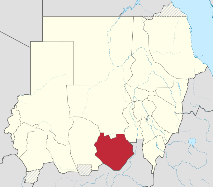
Deutsch: Lage des Staates XY (siehe Dateiname) im Sudan.
English: Locator map of South Kurdufan state, in the Kurdufan region — in post-2011 Sudan.
|
| ⧼wm-license-information-date⧽ | 2011 |
| ⧼wm-license-information-source⧽ | ⧼Wm-license-own-work⧽قالب:Adobe Illustratorقالب:Commonistقالب:AttribSVG |
| ⧼wm-license-information-author⧽ | قالب:TUBS |
| ⧼wm-license-information-other-versions⧽ |
ترخيص
|
تاريخ الملف
اضغط على زمن/تاريخ لرؤية الملف كما بدا في هذا الزمن.
| زمن/تاريخ | صورة مصغرة | الأبعاد | مستخدم | تعليق | |
|---|---|---|---|---|---|
| حالي | ★ مراجعة معتمدة 05:23، 25 أكتوبر 2023 | | 1٬654 × 1٬450 (353 كيلوبايت) | Pastakhov (نقاش | مساهمات) | Upload https://upload.wikimedia.org/wikipedia/commons/4/41/South_Kurdufan_in_Sudan_%28Kafia_Kingi_disputed%29.svg |
لا يمكنك استبدال هذا الملف.
وصلات
لا يوجد صفحات تصل لهذه الصورة.
.svg&oldid=3243116)