ملف:South Georgia Island as seen by Sentinel-2.jpg
حجم هذه المعاينة: 791 × 600 بكسل. البعدان الآخران: 2٬560 × 1٬941 بكسل | 7٬618 × 5٬777 بكسل.
الملف الأصلي (7٬618 × 5٬777 بكسل حجم الملف: 4٫15 ميجابايت، نوع MIME: image/jpeg)
وصف قصير
| ⧼wm-license-information-description⧽ |
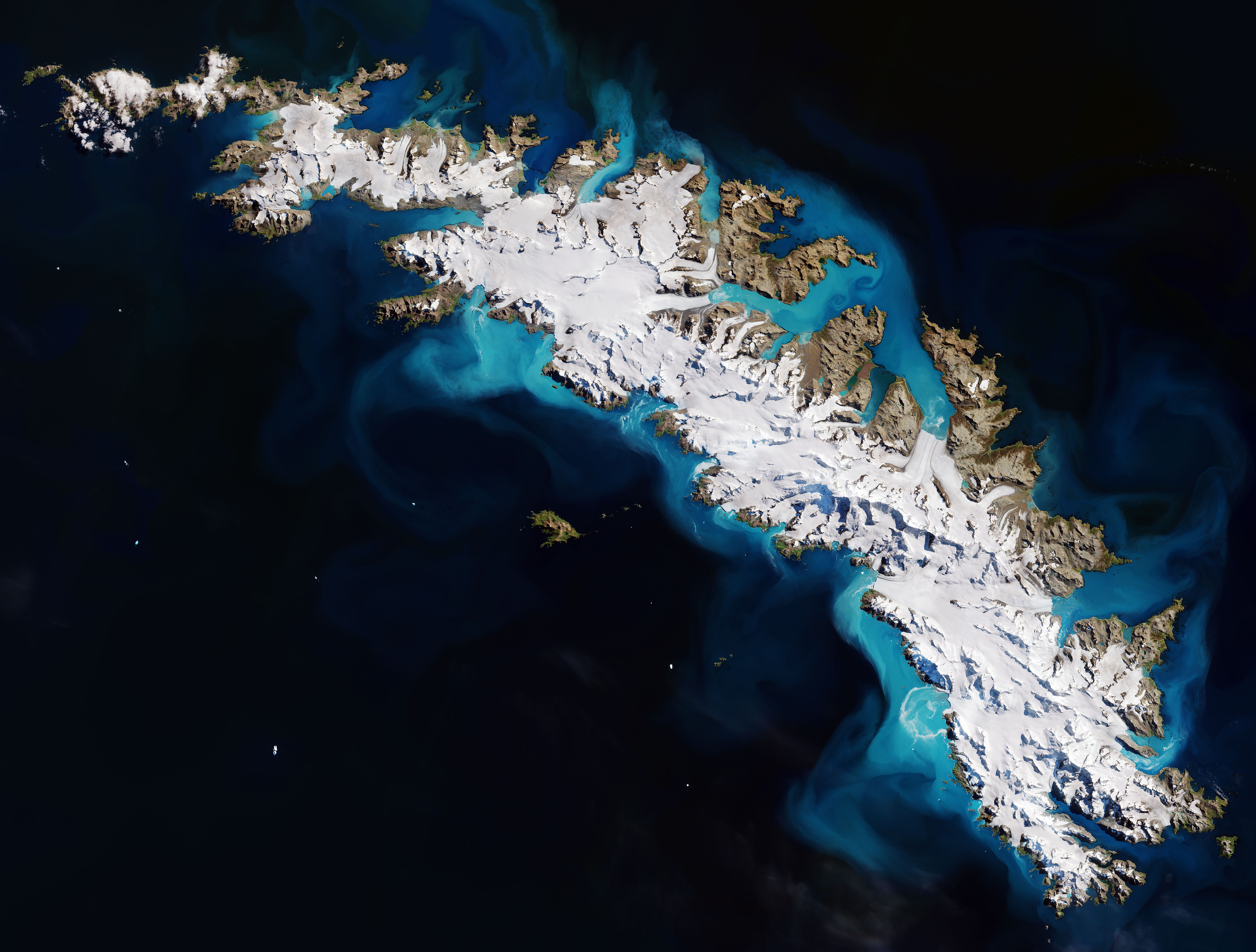
العربية: جزيرة جورجيا الجنوبيَّة كما بدت من مسبار كوپرتيكوس سنتینل-2. تتصل هذه الجزيرة الأطلسيَّة الجنوبيَّة مع جزر ساندويتش الجنوبيَّة لِتُشكِّل إحدى أقاليم ما وراء البحار البريطانيَّة.
English: The island of South Georgia as seen from The Copernicus Sentinel-2 mission. This southern Atlantic island is linked with the South Sandwich Islands to form a British Overseas Territory.
Español: La Isla Georgia del Sur vista desde el satelite Sentinel-2 de la Agencia Espacial Europea.
|
| ⧼wm-license-information-date⧽ | 2018 |
| ⧼wm-license-information-source⧽ | https://www.flickr.com/photos/europeanspaceagency/44587104320/in/feed Contains modified Copernicus Sentinel data (2018), processed by ESA |
| ⧼wm-license-information-author⧽ | European Space Agency |
قالب:Assessment
|
ترخيص
قالب:Cc-by-sa-3.0-igo قالب:Attribution-Copernicus قالب:FlickreviewR
تاريخ الملف
اضغط على زمن/تاريخ لرؤية الملف كما بدا في هذا الزمن.
| زمن/تاريخ | صورة مصغرة | الأبعاد | مستخدم | تعليق | |
|---|---|---|---|---|---|
| حالي | ★ مراجعة معتمدة 13:21، 25 نوفمبر 2023 | | 7٬618 × 5٬777 (4٫15 ميجابايت) | Pastakhov (نقاش | مساهمات) | Upload https://upload.wikimedia.org/wikipedia/commons/3/32/South_Georgia_Island_as_seen_by_Sentinel-2.jpg |
لا يمكنك استبدال هذا الملف.
وصلات
لا يوجد صفحات تصل لهذه الصورة.