ملف:Snow in Coastal North Carolina 2010-02-14.jpg
حجم هذه المعاينة: 600 × 600 بكسل. البعد الآخر: 720 × 720 بكسل.
الملف الأصلي (720 × 720 بكسل حجم الملف: 455 كيلوبايت، نوع MIME: image/jpeg)
وصف قصير
| ⧼wm-license-information-description⧽ |
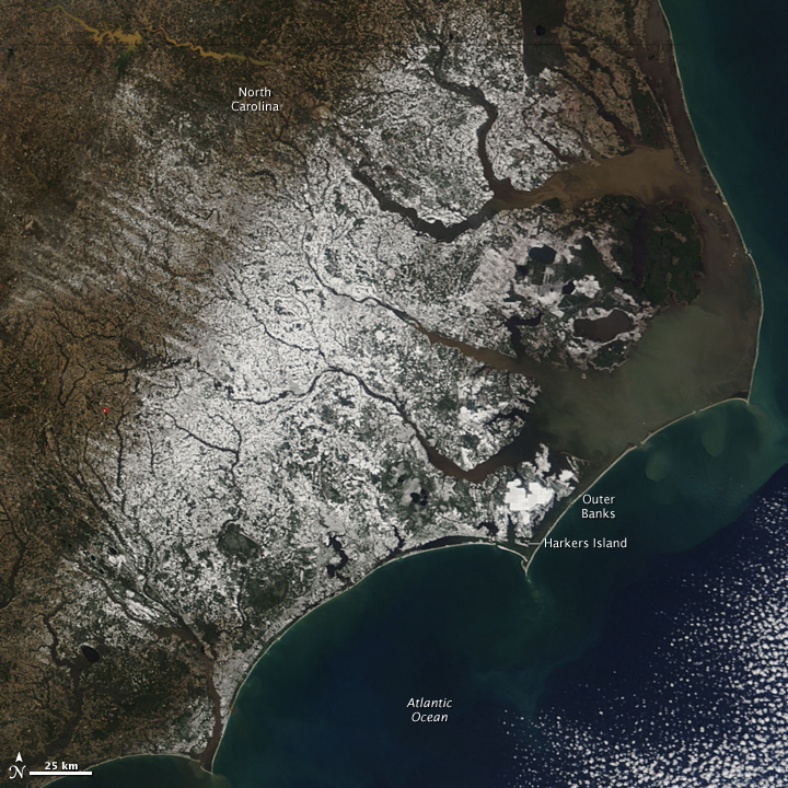
English: With miles of sandy beaches and generally good weather, coastal North Carolina isn’t a place you would usually expect to find snow. But the view from the Moderate Resolution Imaging Spectroradiometer (MODIS) on NASA’s Aqua satellite on February 14, 2010, shows snow extending to the Outer Banks. The sandy islands, normally pale tan, are bright white in this image. Harkers Island received 8.8 inches of snow, reported CNN. The snow fell in a winter storm that moved across the southern United States from Texas to the Atlantic Coast on February 12-13.
|
| ⧼wm-license-information-date⧽ | 2010 |
| ⧼wm-license-information-source⧽ | http://earthobservatory.nasa.gov/NaturalHazards/view.php?id=42698&src=nha |
| ⧼wm-license-information-author⧽ | NASA |
| ⧼wm-license-information-other-versions⧽ |
|
ترخيص
تاريخ الملف
اضغط على زمن/تاريخ لرؤية الملف كما بدا في هذا الزمن.
| زمن/تاريخ | صورة مصغرة | الأبعاد | مستخدم | تعليق | |
|---|---|---|---|---|---|
| حالي | ★ مراجعة معتمدة 12:01، 26 ديسمبر 2023 | | 720 × 720 (455 كيلوبايت) | Pastakhov (نقاش | مساهمات) | Upload https://upload.wikimedia.org/wikipedia/commons/5/5b/Snow_in_Coastal_North_Carolina_2010-02-14.jpg |
لا يمكنك استبدال هذا الملف.
وصلات
لا يوجد صفحات تصل لهذه الصورة.