ملف:Slieve Donard - geograph.org.uk - 1138189.jpg
لا توجد دقة أعلى متوفرة.
Slieve_Donard_-_geograph.org.uk_-_1138189.jpg (640 × 427 بكسل حجم الملف: 247 كيلوبايت، نوع MIME: image/jpeg)
وصف قصير
| ⧼wm-license-information-description⧽ |
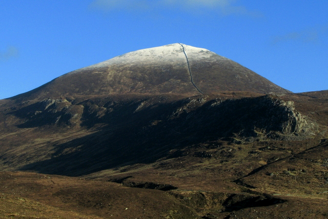
English: Slieve Donard A view of Sleive Donard from south-western edge of Annalong. The south face of Donard, the Mourne Wall is prominent as it rises towards the summit through the snow on the higher ground. The ridge in the foreground is known as the Bog of Donard.
|
| ⧼wm-license-information-date⧽ | 2009 |
| ⧼wm-license-information-source⧽ | From geograph.org.uk |
| ⧼wm-license-information-author⧽ | Ross |
54°09′00″N 5°57′33″W / 54.15012°N 5.9591°W قالب:Object location
_heading:45)
ترخيص
تاريخ الملف
اضغط على زمن/تاريخ لرؤية الملف كما بدا في هذا الزمن.
| زمن/تاريخ | صورة مصغرة | الأبعاد | مستخدم | تعليق | |
|---|---|---|---|---|---|
| حالي | ★ مراجعة معتمدة 19:00، 12 نوفمبر 2023 | | 640 × 427 (247 كيلوبايت) | Pastakhov (نقاش | مساهمات) | Upload https://upload.wikimedia.org/wikipedia/commons/0/09/Slieve_Donard_-_geograph.org.uk_-_1138189.jpg |
لا يمكنك استبدال هذا الملف.
وصلات
لا يوجد صفحات تصل لهذه الصورة.