ملف:Situation in Sievierodonetsk and Lysychansk.svg

حجم معاينة PNG لذلك الملف ذي الامتداد SVG: 800 × 589 بكسل. البعد الآخر: 2٬560 × 1٬886 بكسل.
الملف الأصلي (ملف SVG، أبعاده 1٬226 × 903 بكسل، حجم الملف: 9٫62 ميجابايت)
وصف قصير
| ⧼wm-license-information-description⧽ |
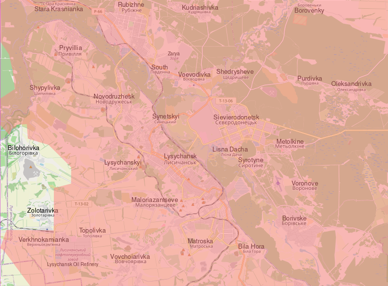
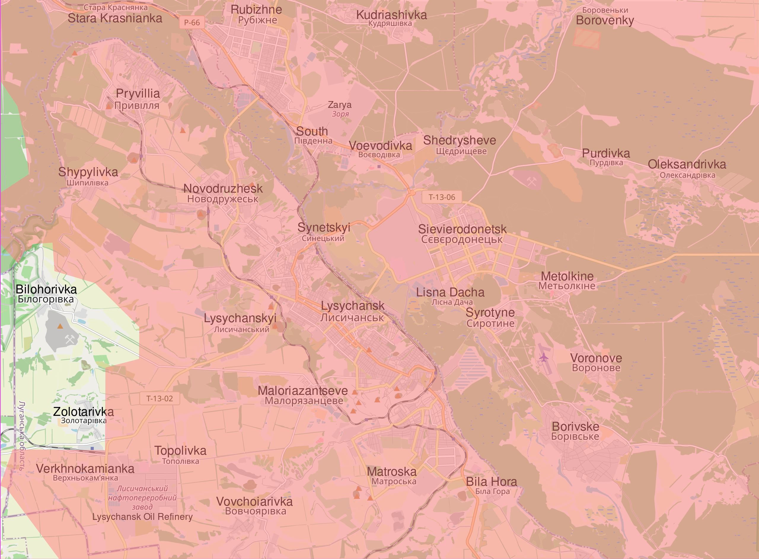
English: Map showing the current situation in and around Sievierodonetsk and Lysychansk. Land in red is controlled by Russia and the Luhansk and Donbas People's Republics. During the 2022 Russian invasion of Ukraine, Sievierodonetsk came under attack from Russian and Luhansk People's Republic forces, and the battle started on 6 May 2022. On 24 June, Ukrainian forces were ordered to withdraw from Sievierodonetsk and city fell the following day. This left the neighbouring Lysychansk as the only notable part of the Luhansk Oblast that remained under Ukrainian control. In the following days, Russia made advances south of Lysychansk, and entered the city on 25 June. Russia announced that it had control of Lysychansk on 2 July after seven days of fighting. This was initially denied by Ukraine, however, the Ukrainian general staff admitted on 3 July that it gave the order to withdraw from the city. The fall of Lysychansk means that the Luhansk People's Republic has complete control of the Luhansk Oblast.
|
| ⧼wm-license-information-date⧽ | 2022 |
| ⧼wm-license-information-source⧽ | ⧼Wm-license-own-work⧽ Control data from the Institute for the Study of War |
| ⧼wm-license-information-author⧽ | Cyrobyte |
ترخيص
تاريخ الملف
اضغط على زمن/تاريخ لرؤية الملف كما بدا في هذا الزمن.
| زمن/تاريخ | صورة مصغرة | الأبعاد | مستخدم | تعليق | |
|---|---|---|---|---|---|
| حالي | ★ مراجعة معتمدة 10:09، 12 أكتوبر 2023 | | 1٬226 × 903 (9٫62 ميجابايت) | Pastakhov (نقاش | مساهمات) | Upload https://upload.wikimedia.org/wikipedia/commons/5/5e/Situation_in_Sievierodonetsk_and_Lysychansk.svg |
لا يمكنك استبدال هذا الملف.
وصلات
لا يوجد صفحات تصل لهذه الصورة.