ملف:Serb lands in the 10th century (en).png
حجم هذه المعاينة: 739 × 599 بكسل. البعد الآخر: 926 × 751 بكسل.
الملف الأصلي (926 × 751 بكسل حجم الملف: 70 كيلوبايت، نوع MIME: image/png)
وصف قصير
| ⧼wm-license-information-description⧽ |
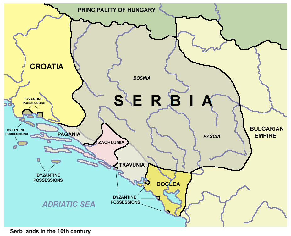
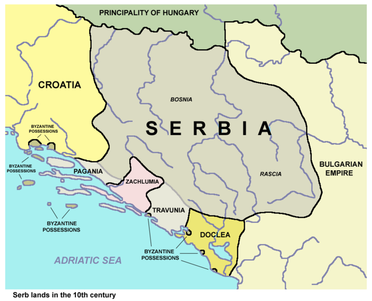
Serb lands in the 10th century. |
| ⧼wm-license-information-date⧽ | 2013 |
| ⧼wm-license-information-source⧽ | ⧼Wm-license-own-work⧽ |
| ⧼wm-license-information-author⧽ | PANONIAN |
ترخيص
References
- Istorijski atlas, Geokarta, Beograd, 1999.
- Miloš Blagojević, Srpska državnost u srednjem veku, Beograd, 2011.
- Vladimir Ćorović, Ilustrovana istorija Srba, knjiga prva, Beograd, 2005.
- Petrit Imami, Srbi i Albanci kroz vekove, Beograd, 2000.
- Školski istorijski atlas, Zavod za izdavanje udžbenika SR Srbije, Beograd, 1970.
- The Times, Atlas Svjetske Povijesti, Cankarjeva založba, Ljubljana - Zagreb, 1986.
- Sima M. Ćirković, Srbi među evropskim narodima, Beograd, 2004.
تاريخ الملف
اضغط على زمن/تاريخ لرؤية الملف كما بدا في هذا الزمن.
| زمن/تاريخ | صورة مصغرة | الأبعاد | مستخدم | تعليق | |
|---|---|---|---|---|---|
| حالي | ★ مراجعة معتمدة 03:37، 16 يناير 2024 | | 926 × 751 (70 كيلوبايت) | Pastakhov (نقاش | مساهمات) | Upload https://upload.wikimedia.org/wikipedia/commons/6/66/Serb_lands_in_the_10th_century_%28en%29.png |
لا يمكنك استبدال هذا الملف.
وصلات
لا يوجد صفحات تصل لهذه الصورة.
.png&oldid=3890851)
تصنيفات:
- Self-published work
- Maps of the history of Serbia in the Early Middle Ages
- Maps of the history of Montenegro in the Early Middle Ages
- Maps of medieval Bosnian and neighboring states
- Maps of the history of Herzegovina
- Maps of Pagania
- Maps of Zachlumia
- Maps of Travunija
- Maps of Duklja
- Maps of the Principality of Serbia (early medieval)