ملف:Seattle - South Park map.jpg
حجم هذه المعاينة: 557 × 599 بكسل. البعد الآخر: 774 × 833 بكسل.
الملف الأصلي (774 × 833 بكسل حجم الملف: 153 كيلوبايت، نوع MIME: image/jpeg)
وصف قصير
| ⧼wm-license-information-description⧽ |
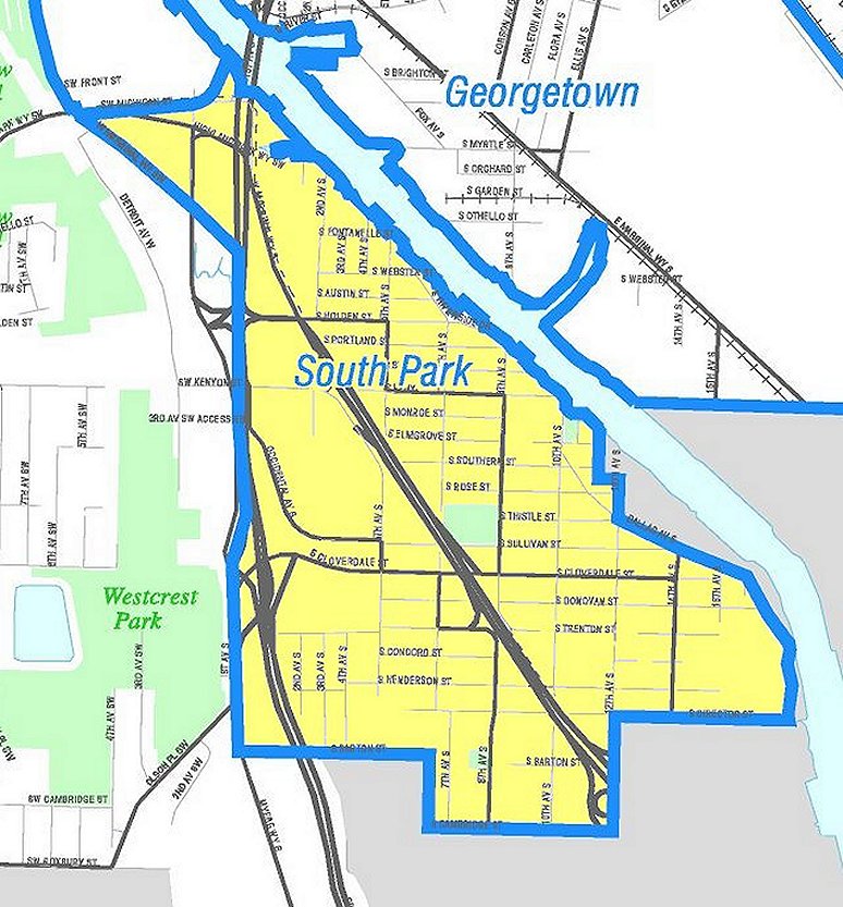
English: Map of Seattle's South Park neighborhood. Like the other maps from the Seattle City Clerk's Neighborhood Map Atlas, this is not an official map; in particular, borders are not official.
|
| ⧼wm-license-information-date⧽ | Retrieved from Seattle City Clerk's Neighborhood Map Atlas 23 أبريل 2011 |
| ⧼wm-license-information-source⧽ | South Park, map NN-1470L from Seattle City Clerk's Neighborhood Map Atlas. |
| ⧼wm-license-information-author⧽ | Office of the Seattle City Clerk |
| ⧼wm-license-information-permission⧽ (⧼wm-license-information-permission-reusing-text⧽) |
PD-Seattle-Neighborhood-Atlas. |
ترخيص
تاريخ الملف
اضغط على زمن/تاريخ لرؤية الملف كما بدا في هذا الزمن.
| زمن/تاريخ | صورة مصغرة | الأبعاد | مستخدم | تعليق | |
|---|---|---|---|---|---|
| حالي | ★ مراجعة معتمدة 22:19، 26 أكتوبر 2023 | | 774 × 833 (153 كيلوبايت) | Pastakhov (نقاش | مساهمات) | Upload https://upload.wikimedia.org/wikipedia/commons/f/fa/Seattle_-_South_Park_map.jpg |
لا يمكنك استبدال هذا الملف.
وصلات
لا يوجد صفحات تصل لهذه الصورة.