ملف:Saxony GR.svg

حجم معاينة PNG لذلك الملف ذي الامتداد SVG: 750 × 600 بكسل. البعد الآخر: 2٬560 × 2٬048 بكسل.
الملف الأصلي (ملف SVG، أبعاده 2٬268 × 1٬814 بكسل، حجم الملف: 1٫28 ميجابايت)
وصف قصير
| ⧼wm-license-information-description⧽ |
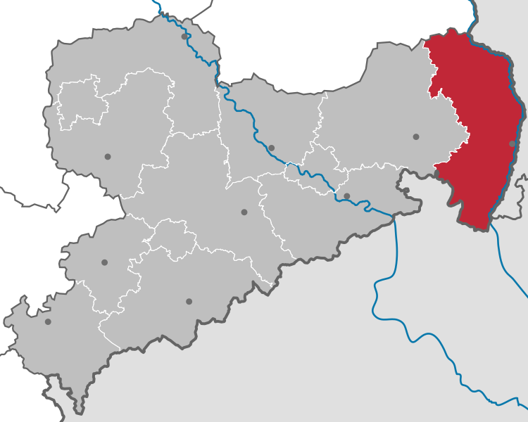
Deutsch: Karte des Landes Sachsen in Deutschland, gegliedert in 10 Landkreise und drei kreisfreie Städte (Stand nach der Kreisreform Sachsen 2008). Rot hervorgehoben ist der Landkreis Görlitz im Osten innerhalb des schwächer hervorgehobenen Direktionsbezirks Dresden
|
| ⧼wm-license-information-date⧽ | 2009 |
| ⧼wm-license-information-source⧽ | قالب:Adobe Illustrator
⧼Wm-license-own-work⧽, based on: |
| ⧼wm-license-information-author⧽ | Hagar66 based on work of قالب:TUBS |
ترخيص
|

|

تاريخ الملف
اضغط على زمن/تاريخ لرؤية الملف كما بدا في هذا الزمن.
| زمن/تاريخ | صورة مصغرة | الأبعاد | مستخدم | تعليق | |
|---|---|---|---|---|---|
| حالي | ★ مراجعة معتمدة 20:14، 26 نوفمبر 2023 | | 2٬268 × 1٬814 (1٫28 ميجابايت) | Pastakhov (نقاش | مساهمات) | Upload https://upload.wikimedia.org/wikipedia/commons/6/6d/Saxony_GR.svg |
لا يمكنك استبدال هذا الملف.
وصلات
لا يوجد صفحات تصل لهذه الصورة.