ملف:Satellitenbild Tsumeb.jpg
حجم هذه المعاينة: 623 × 600 بكسل. البعد الآخر: 801 × 771 بكسل.
الملف الأصلي (801 × 771 بكسل حجم الملف: 154 كيلوبايت، نوع MIME: image/jpeg)
| ⧼wm-license-information-description⧽ |
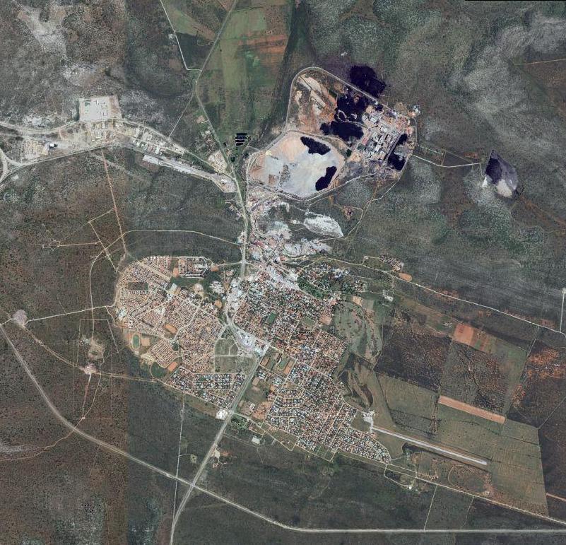
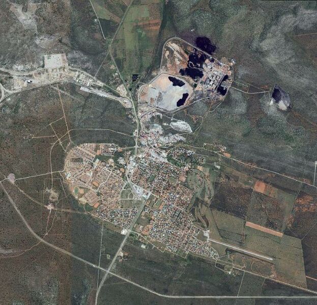
Deutsch: Satellitenbild der Stadt Tsumeb, Namibia; zu sehen sind die Bergminen in der oberen Bildhälfte
English: satellite picture of the city of Tsumeb, Namibia. visible the mines in the upper section of the image
|
| ⧼wm-license-information-date⧽ | 2007 |
| ⧼wm-license-information-source⧽ | from Nasa World Wind http://www.worldwind.arc.nasa.gov/ |
| ⧼wm-license-information-author⧽ | self |
| ⧼wm-license-information-permission⧽ (⧼wm-license-information-permission-reusing-text⧽) |
Free Satellite Image |
تاريخ الملف
اضغط على زمن/تاريخ لرؤية الملف كما بدا في هذا الزمن.
| زمن/تاريخ | صورة مصغرة | الأبعاد | مستخدم | تعليق | |
|---|---|---|---|---|---|
| حالي | ★ مراجعة معتمدة 12:51، 29 أكتوبر 2023 | | 801 × 771 (154 كيلوبايت) | Pastakhov (نقاش | مساهمات) | Upload https://upload.wikimedia.org/wikipedia/commons/c/c7/Satellitenbild_Tsumeb.jpg |
لا يمكنك استبدال هذا الملف.
وصلات
لا يوجد صفحات تصل لهذه الصورة.